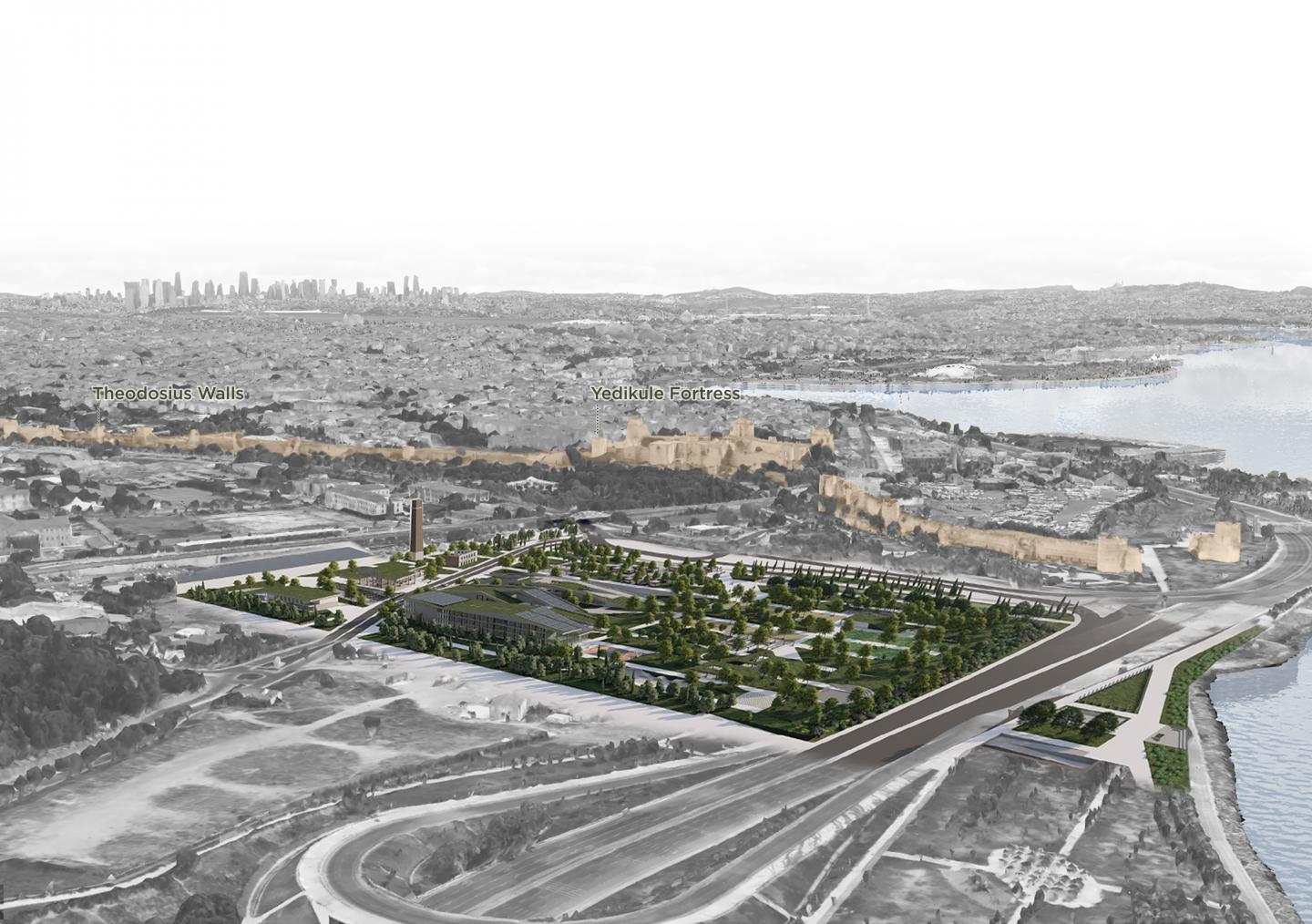
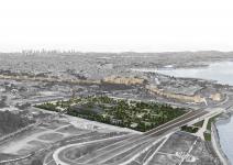
Istanbul has been under different civilizations since the past and still has traces of them. When the historical peninsula is examined, the city walls from various periods, some of which have been destroyed and some partially standing, show these traces.
The most standing of these walls are the walls built during the reign of Theodosius. These walls consist of 3 levels and were one of the best defense systems during their period. But of course, it is known that urban agriculture was practiced around and inside these walls when they were not being used for war purposes. So, urban gardening is an activity that has existed in the city since the Byzantine period.
When we look at the historical timeline of the urban framework, the city center of Istanbul was only inside the city walls. So, industrial activities were taking place outside the city and the city walls.
In the 1960s, some settlements near the factories, mostly squatter settlements, emerged. With industrialization, the factory workers started to live near the industrial zones.
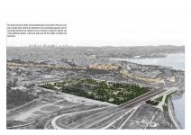
In 1993, with rapid urbanization, the factories remained in the city center. So the government decided to move this area out of the city. Some of the factories in the area were demolished, and some were left as they were.
Today, this former industrial zone is an empty, unskilled, and deserted void in the city, affecting social life.
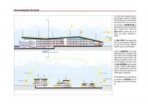
In summer and winter, the region experiences intense southeast and northwest winds, and north winds also prevail in summer.
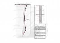
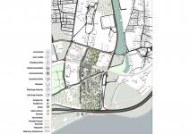
When Istanbul is examined in the historical process, the land walls that form the borders of the city have remained within the city with urbanization activities over the years. Naturally, the people who wanted to pass through the city walls through the existing city wall gates or, in some places, by destroying the city wall, caused the formation of new horizontal axes. These horizontal axes can be read very clearly in the urban context. The aim is to create vertical stripes that can cross the axes dividing the fortifications horizontally without interruption, referring to the verticality of the fortification trace.
Although these horizontal axes provide transportation into the city, they cut the city’s connection with the sea and the circulation within the neighborhood itself.
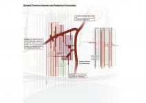
The design is based on climatic and environmental data. The proximity of the area to the active transportation network, the distribution of the surrounding population, and the surrounding functions have enabled the area to function as housing for students and urban gardening education, activity, and trade areas for the residents of Istanbul and Kazlıcesme.
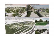
The goal is to create a dynamic topography in green spaces by manipulating slopes, similar to rooftop designs. This topography allows an uninterrupted pedestrian flow from the station to the sea, with an underground passage, to reach the other side of the road without passing the street. With this approach, reusing the excavated soil while achieving a sense of continuity within the context is possible.
A roof was created at the train station to let in more sunlight and generate energy. In addition, while some of the roofs of the buildings designed as green roofs are open to walking and circulation, it is aimed to generate energy with solar panels on sloping green roofs where there is no pedestrian circulation.
The region is under the effect of intense southeast and northwest winds in summer and winter. In addition to this, north winds also prevail in summer. Considering these, evergreen trees were planted around the perimeter of the area to protect it from winter winds. The north winds are circulated in a way to increase the cooling effect inside the area in summer.
In this way, it is possible to generate energy by taking advantage of the intensity of the wind. To maximize the benefit from the wind, wind energy production spots have been identified in parts of the area that are directly exposed to the wind.
Rain gardens were placed on the edges to take advantage of wind and water.
By creating a dynamic topography, the targeted continuity was achieved, and uninterrupted axes were created from the train station to the sea. Continuity was achieved by creating a dynamic topography and an uninterrupted axis starting from the train station and continuing to the sea. At the same time, the excavated and demolished soil was reused in the topography movements to close the loop.
The complex is interconnected both underground and on the ground floor, making the flexible use of functions, while the upper floors are for the exclusive use of students. At the same time, the layout of the plans allows to connect both sides of the road, creating a continious circulation. This creates a connection between the train station and the coastline.
2025
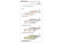
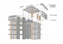
The project features a hybrid structural system that combines wood-concrete composite slab panels with a concrete core and wooden columns. This approach optimizes structural performance, sustainability, and material efficiency. The concrete cores provide stability and load-bearing capacity, while the wooden columns contribute to a lighter, more flexible structure with a reduced carbon footprint. By leveraging the thermal mass of concrete and the renewable qualities of wood, the design enhances both environmental efficiency and structural resilience, aligning seamlessly with the project's climate-responsive vision.
The facade is clad with GFRC (Glass Fiber Reinforced Concrete) panels, offering a durable, lightweight, and adaptable envelope. The roofs are designed as green roofs, improving thermal insulation and contributing to urban biodiversity. Additionally, in certain areas of the buildings, the roof’s slope creates air gaps between the green roof and the top floor ceiling, further enhancing passive ventilation and thermal performance.
Designer: Sena Sarıkaya
Supervisor: Angelo Figliola
Sena Sarıkaya


Favorited 1 times