The Mekong Delta, Vietnam – for generations, has been a place where people have lived closely connected to the alluvium and rhythm of the river. Here, the land is not only the foundation for construction, but also a place to preserve memories, a form of living heritage of this land.
However, over time, I have begun to witness increasingly obvious changes. Climate change, landslides, salinity or ecological imbalance… all are gradually eroding this fertile delta. And in that context, recording, preserving and recreating the process of forming this land has become an urgent matter. Not only is it the role of an architectural work, but also a reminder – of the relationship between humans and their own living environment.
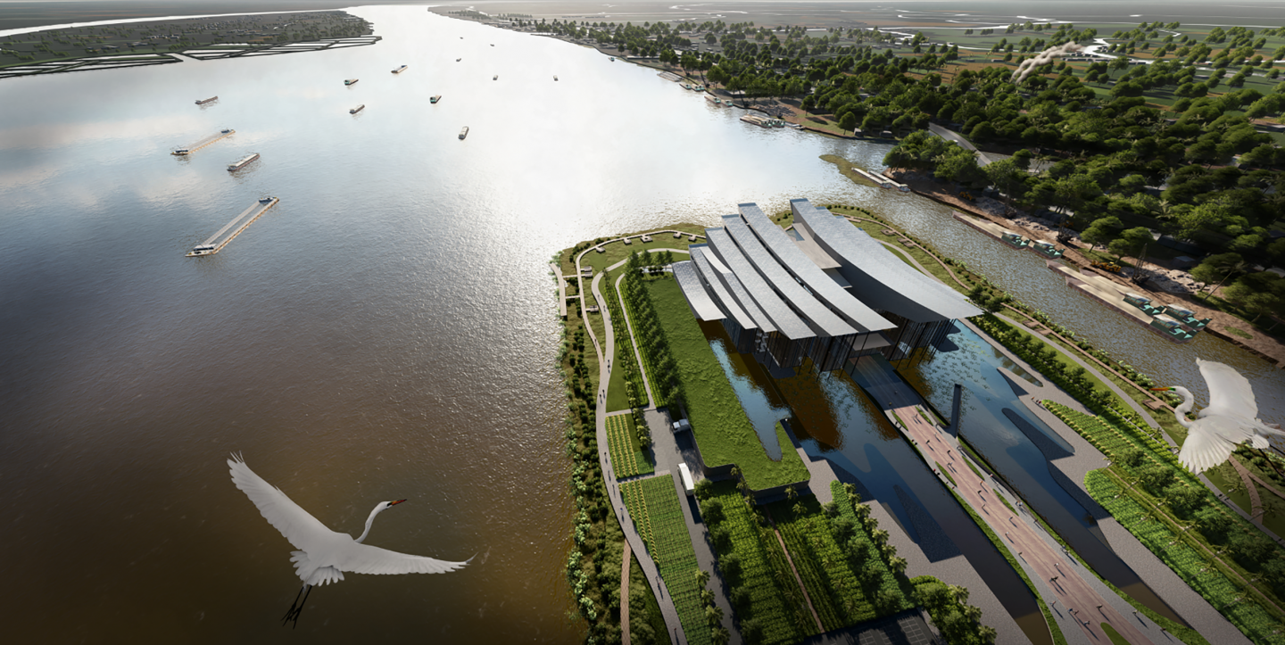
The Mekong Delta Geological Museum was formed from that need. This project is not simply a place to display artifacts, where each layer of geological strata becomes a language, and alluvium becomes a material for people to better understand the place they live. Through the museum, the journey of thousands of years of land formation will be looked back on.
1. Summary of the reasons for choosing the topic:
- First, to preserve geological values and formation history.
- Second, to raise public awareness of the place where they live and environmental change.
- Third, the museum will act as a new educational method, helping people access knowledge in a multi-dimensional way.
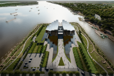
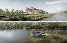
2. About the location of the land: The land is located on the Co Chien River, in the area of My An commune, bordering Mang Thit district and Vinh Long city. Reasons for choosing the land:
- First, it is located in the center of the Mekong River - an important factor forming the theme of this delta region.
- Second, located in Vinh Long province, a province located in the center of the Mekong Delta in Vietnam, easily accessible from other provinces and cities.
- Third, the project can resonate with existing or future museum projects of Vinh Long city to form a "museum cluster" tourism axis of the Mekong Delta in Vietnam.
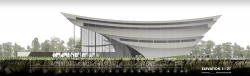
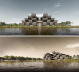
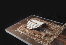
3. The idea of creating the shape comes from the image of a strong alluvial flow from upstream to downstream, then tends to flare to form the appearance of this delta. That is the reason why the block of the project has a curved shape that gradually slopes from high to low and when viewed from above, it tends to expand later. The project is divided into small blocks that gradually level down. Looking from the side elevation, each curve can be seen as layers of alluvial sediment that accumulate to form the delta land here.
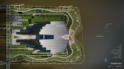
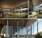
4. On the overall plan, the main block is located at position 1/3 to emphasize the forward sliding. The front square and the back yard are connected through a radial axis and a large lake in front of the building. The warehouse/factory block is ordered to one side with the least interaction with the remaining river bank, the walkways are arranged around on different elevations to increase interaction for users.
2025
1. Location: Vinh Long, Vietnam.
2. Gross floor area: 18,000 m²
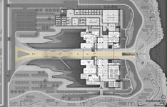
3. The project consists of 3 main floors, 1 ground floor and 2 upper floors:
- Ground floor ( 0,000), including Public area and Storage/Laboratory.
- Mezzanine floor ( 3,500), including Research and Administration area.
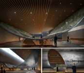
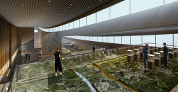
- 1st floor ( 7,000), including Display area.
- 2nd floor ( 15,000), including Display area.
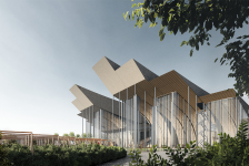
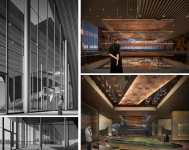
4. The main material of the project is concrete. The sides in the thematic spaces will be treated with earth and stone to create a rough feeling and suitable for the meaning of each theme.
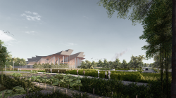
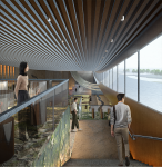
5. The idea of taking natural light from the long glass rows along the side of the building helps the interior space to be expanded on both sides as well as helps visitors define the flow of movement when visiting. Of course, the solution for the glass used is electric glass with the ability to adjust the opacity to help limit harsh light and UV rays from entering deep inside.
6. Because it is built on weak ground, with 3 sides facing the river. In addition to using reinforced concrete pile foundations, I propose that there must be a solid embankment, but it does not hug the entire boundary of the land because it will prevent human interaction with the river and that solution is not the current trend. Instead, the landscape will be separated into 2 different heights:
- One is the height of 0.000, here the landscape will be as high as the ground floor and as high as the urban sidewalk, the solid embankments will surround this landscape and hold the ground firmly.
- Two is the height of -1.000, which is the remaining landscape outside, where it will be directly affected by the river tide, helping visitors walking above to easily feel and interact with the river.
Designer: Khanh Duy Vo Nguyen
Supervisor: Phu Cuong Pham
The Geological Museum Of The Vietnamese Mekong Delta by Khanh Duy Vo Nguyen in Vietnam won the WA Award Cycle 51. Please find below the WA Award poster for this project.

Downloaded 0 times.

Khanh Duy Vo Nguyen


Favorited 6 times