Submitted by WA Contents
ONZ Architects + MDesign unveil design for Sivas Kızılırmak River Bank Development in Turkey
Turkey Architecture News - Aug 08, 2016 - 16:23 31720 views

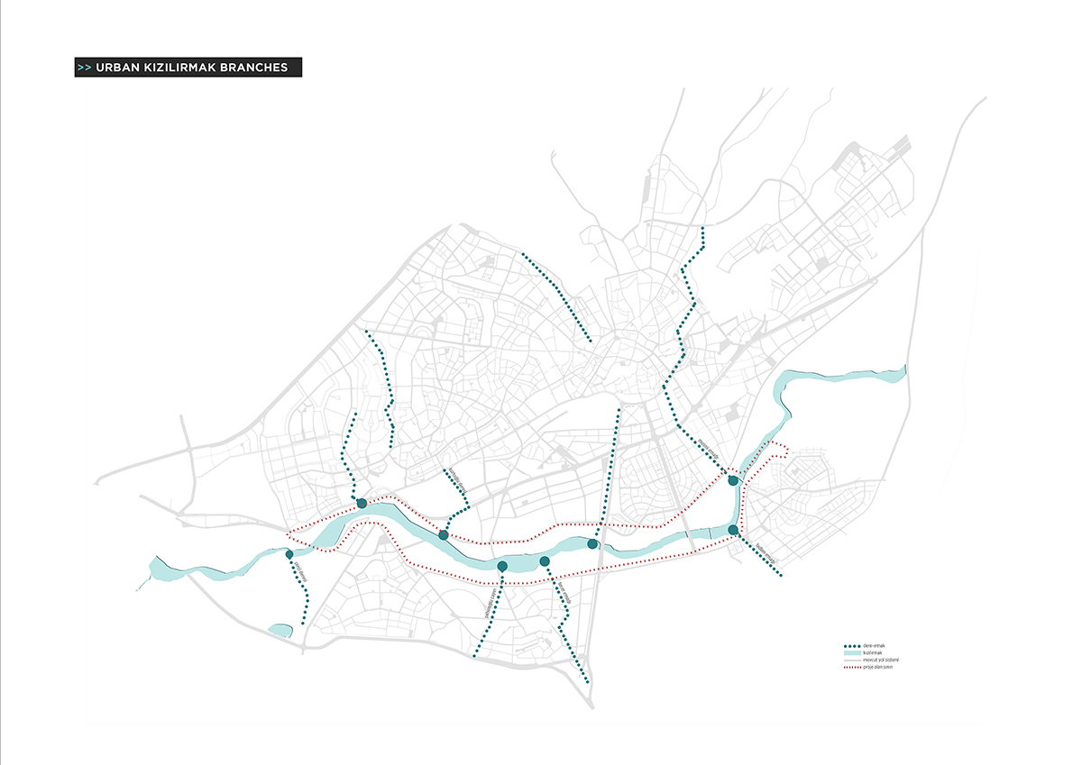
ONZ Architects and MDesign have unveiled their winning-design proposal for Sivas Kızılırmak River Bank Development Urban Design & Architectural Competition, the team has won 3rd prize in the competition with their curvaceous-formed and flexible structures. The competition was opened by the Sivas Municipality for the design of 6 million square meters of land by the Kızılırmak River in Sivas. Kızılırmak is the longest river entirely within Turkey and until today it acted as a barrier dividing the city Sivas.
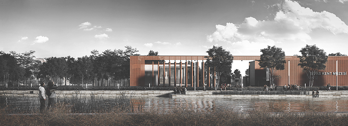
The competition aim was to bring together the two sides of the river with a holistic urban design along with recreational and cultural design elements. The competition was a pre-selected competition and eight groups were chosen for the second stage. Kızılırmak is the longest river entirely within Turkey and until today it acted as a barrier dividing the city Sivas.
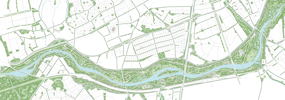
Kızılırmak River’s impact on the urban life has remained limited due to parameters like security and accessibility, for this reason it has been characterized as a natural threshold with the separation displaced from the city perimeters.
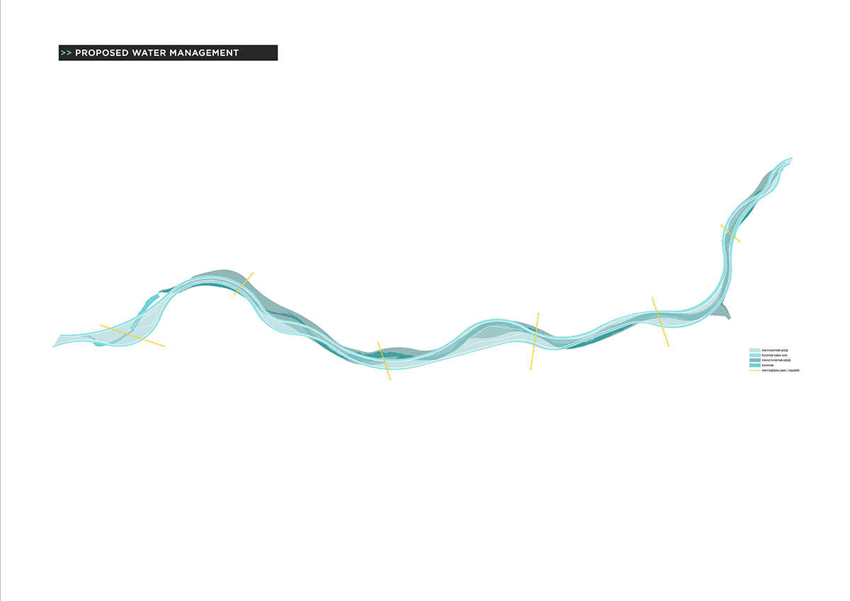
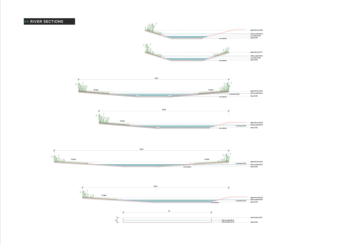
Nowadays keeping the flood area under control with the reclamation studies brings up the opportunity and possibility to redefine the city macroform. In the near future it is predicted for Kızılırmak Corridor to play a lead role on the ecological diversity, the recreational potential and the scale defining areas reserved for sociocultural function set.
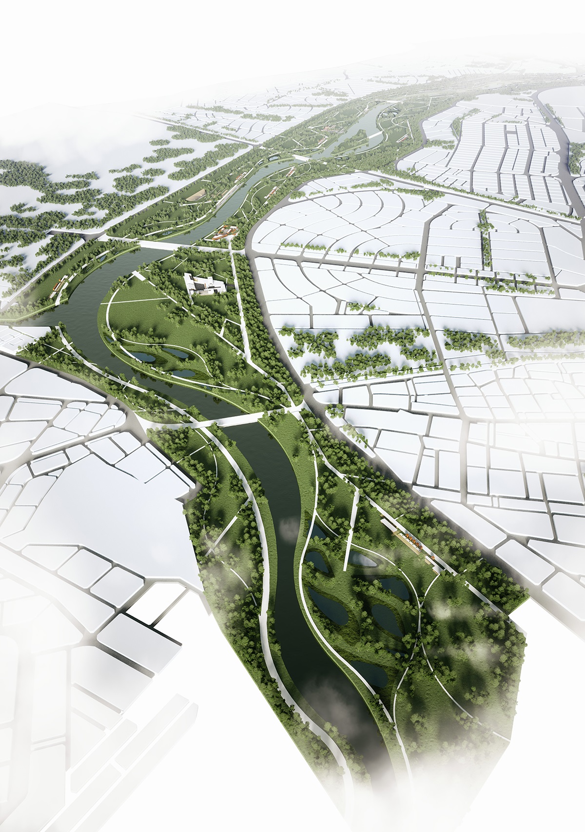
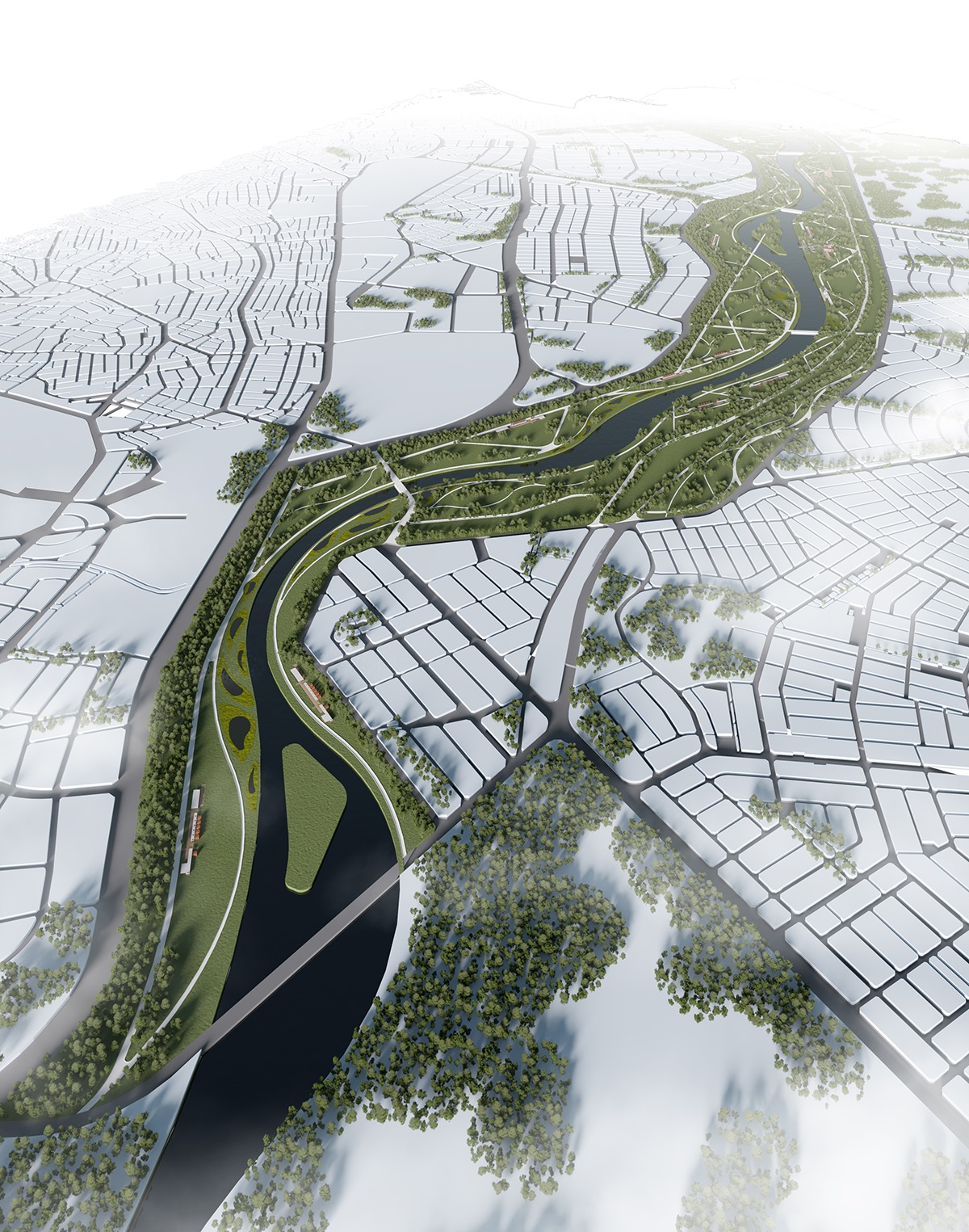
Areal view
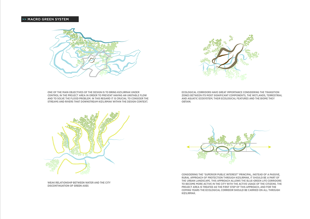
Two studio's proposal has been envisioned to bring the city and the citizens with this particular water footprint while having a protect-use vision. It is essential to plan the landuse for the sustainable resource consumption, considering a protect – use balance since the demand for converting these areas with high natural potential to recreational areas raises day by day.

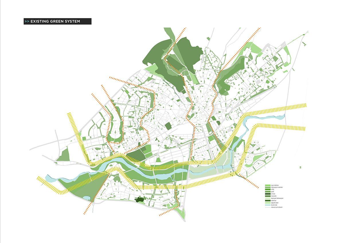
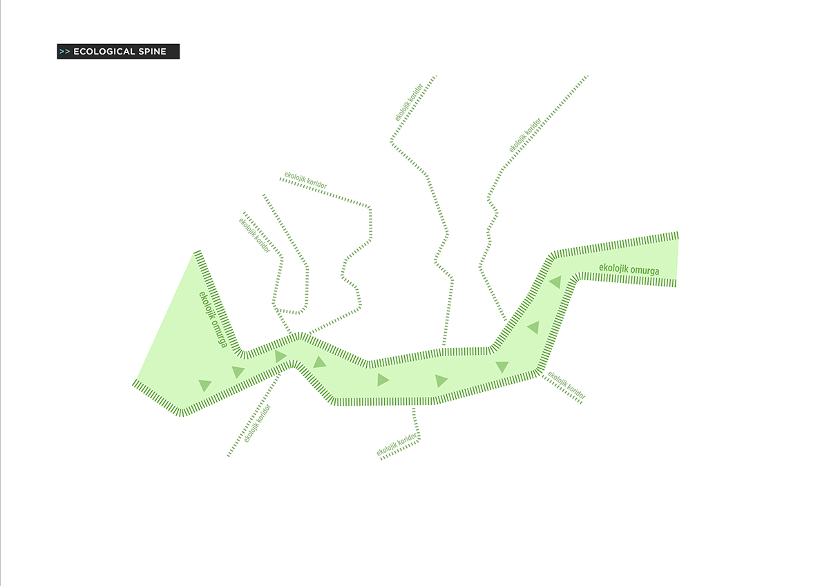
As presenting the proposals, in order to develop proper design options that last for the next generations, the approach of “sustainable design and management with nature” has been sought considering the protect – use balance of natural values. The design of the project area (as an ecological and recreational spine) is considered a very important opportunity from a “more livable Sivas” perspective.
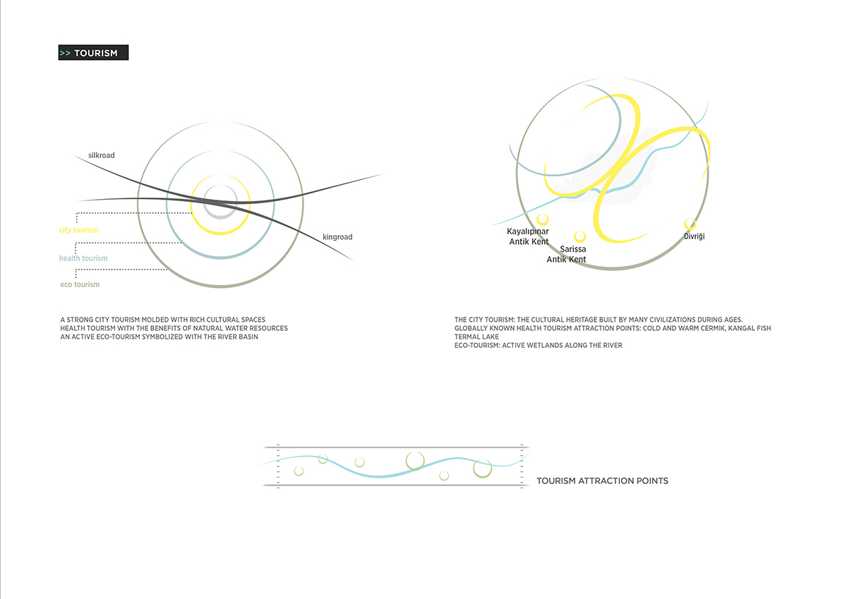
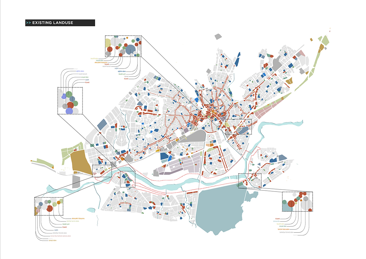
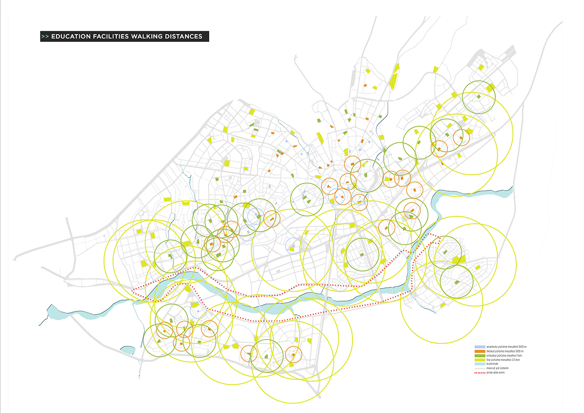
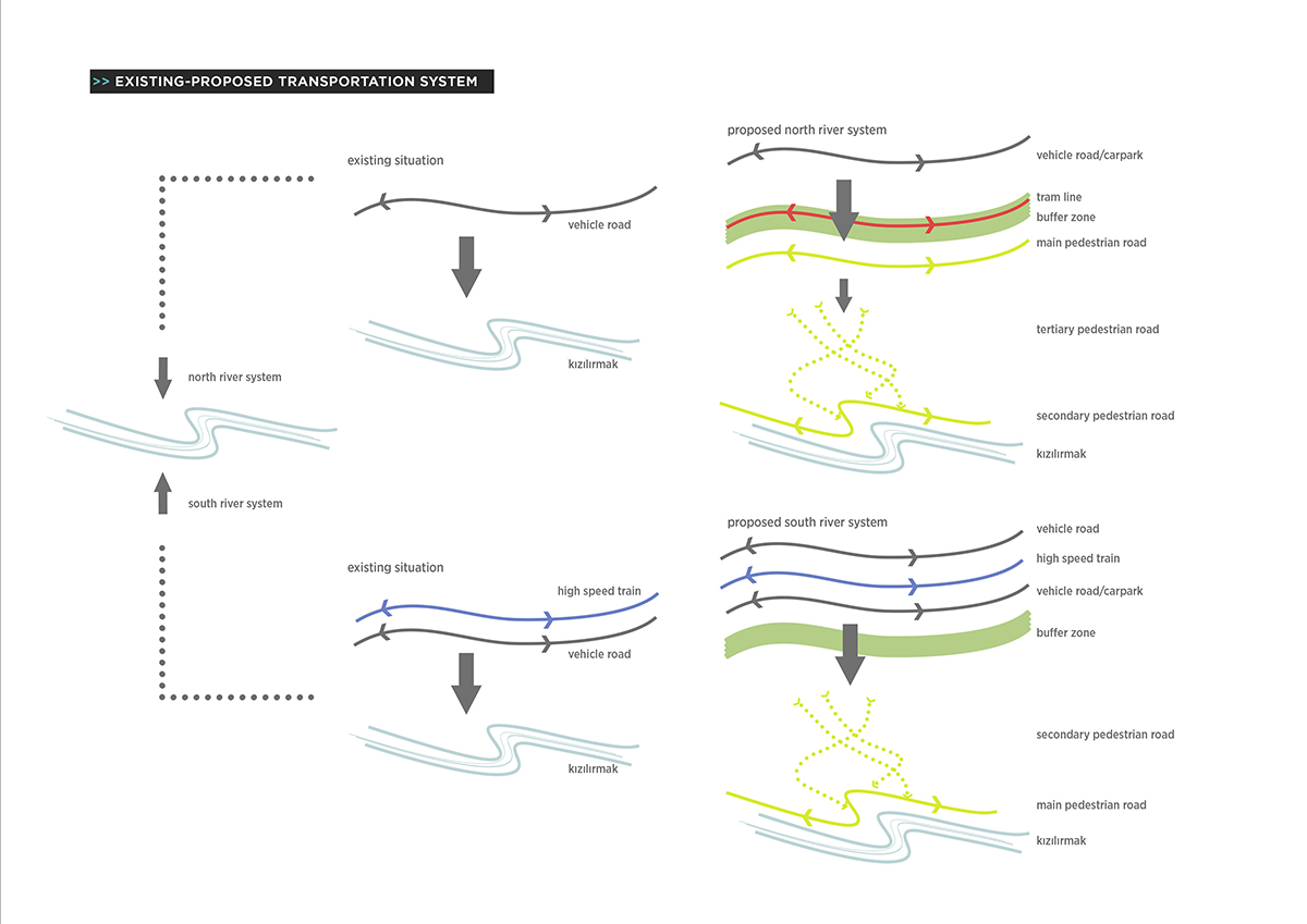
The project area is approximately 6.5 million square meters, where the closest distance to the city center is 3.5 kilometers. An important input that affects the design desicions is to be bounded by the dense urban tissue and the peripheral road on the north while being surrounded by the high speed rail line, the urban tissue and the university campus on the south.

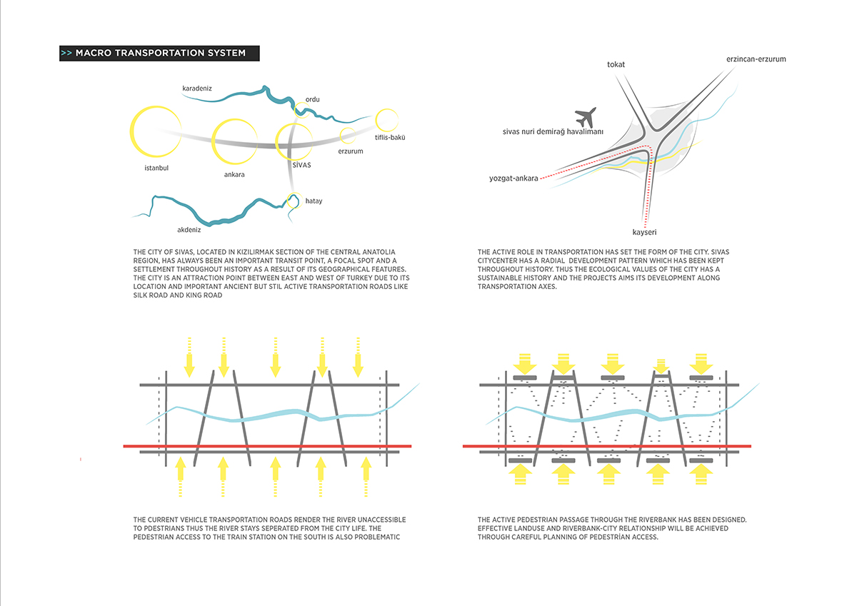
On Kızılırmak, dividing the city into two, is considered to have a total of eight bridges with the available ones among the planned bridges. These bridges provide an important input on the design process. While the bridges are considered as physical and visual barrier for many design projects, in this study they are contemplated as important traces and transportation channels that define significant elements of the design. In addition, the two historical bridges (Eğri Köprü and Kesik Köprü) located on the east and the west site are the historical connection points of the project.
In addition to these eight bridges, an activity and faunal continuity bridge that connects the activity island to the project site is designed. Another purpose of this pedestrian bridge is to provide the continuity and transmission of the fauna on the ecological spine and the ecological corridors.
For the ease of application it is envisaged to design the area in phases. There are five phases planned in this regard, however during the application some phases may be merged if necessary.
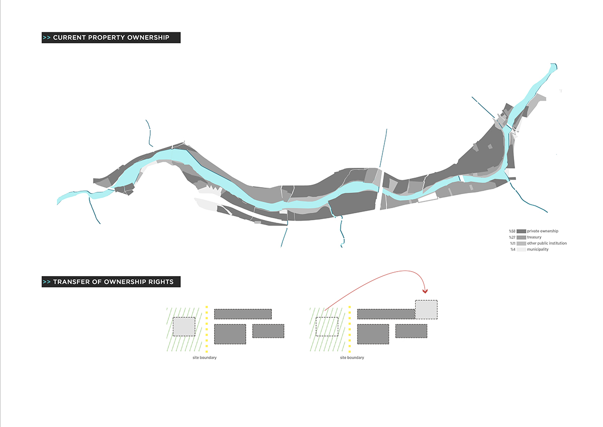
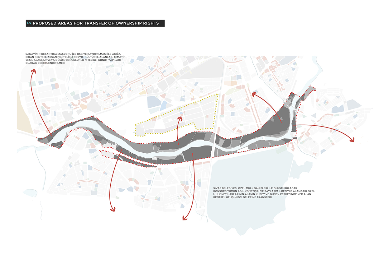
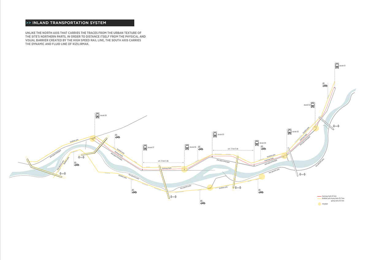
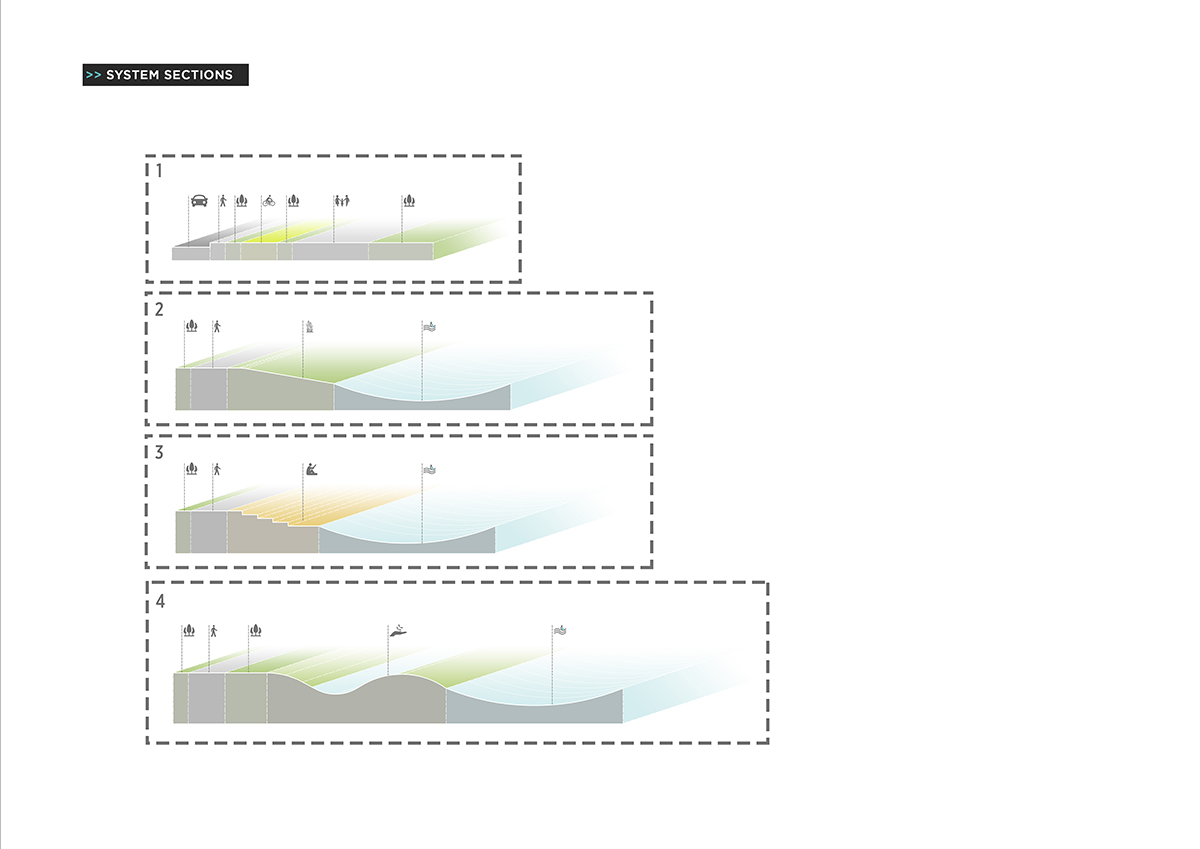
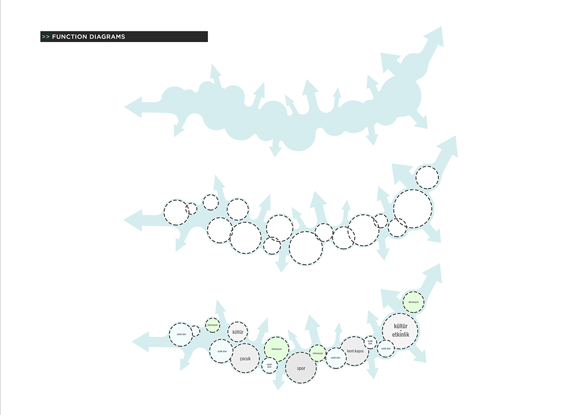
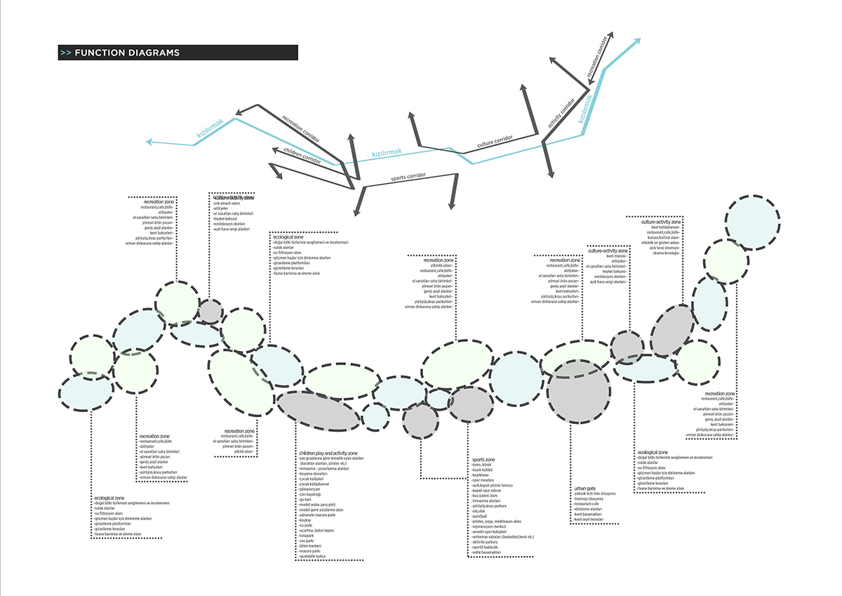
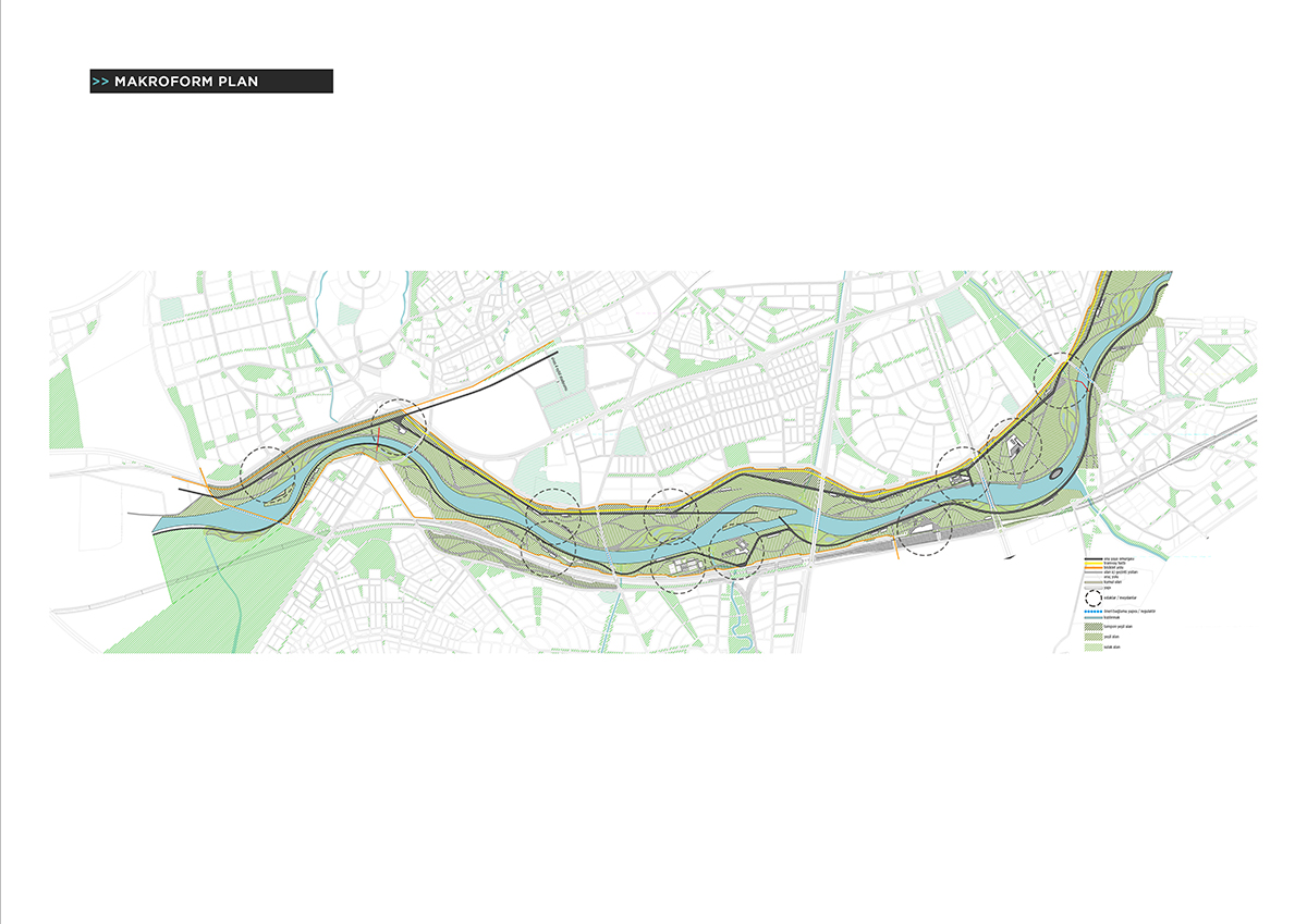
The site is zoned and shaped by the protect-use policy, which is one of the highlights of the design. The zoning and the shaping is planned according to the event and function calendar, the transportation and land use analyses. From all these zoning and shaping in the project site and inbetween of these stains the main transportation line finds its form.
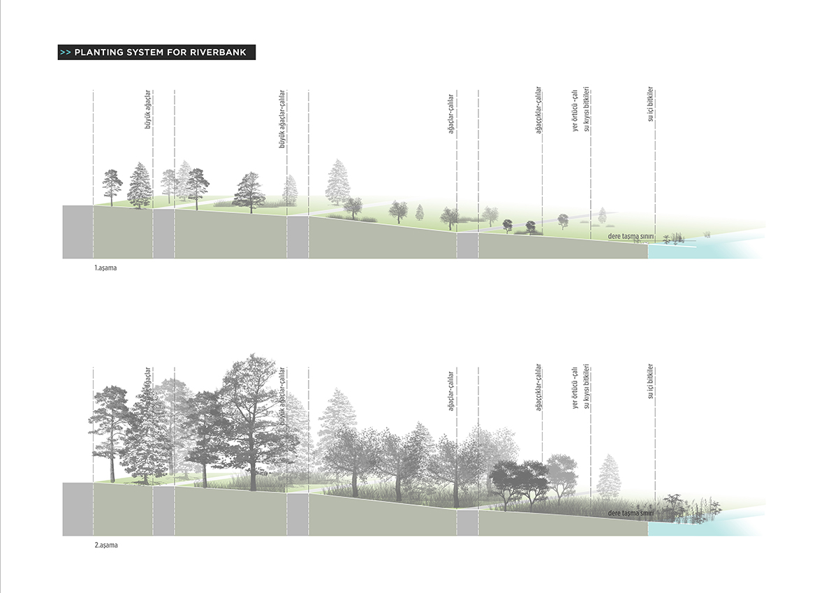
Described as a green spine, Kızılırmak is surrounded by many functions like a DNA helix. In regards to the size and maintenance of the site it is planned to plant and sale local vegetations on the fields in the near surroundings.
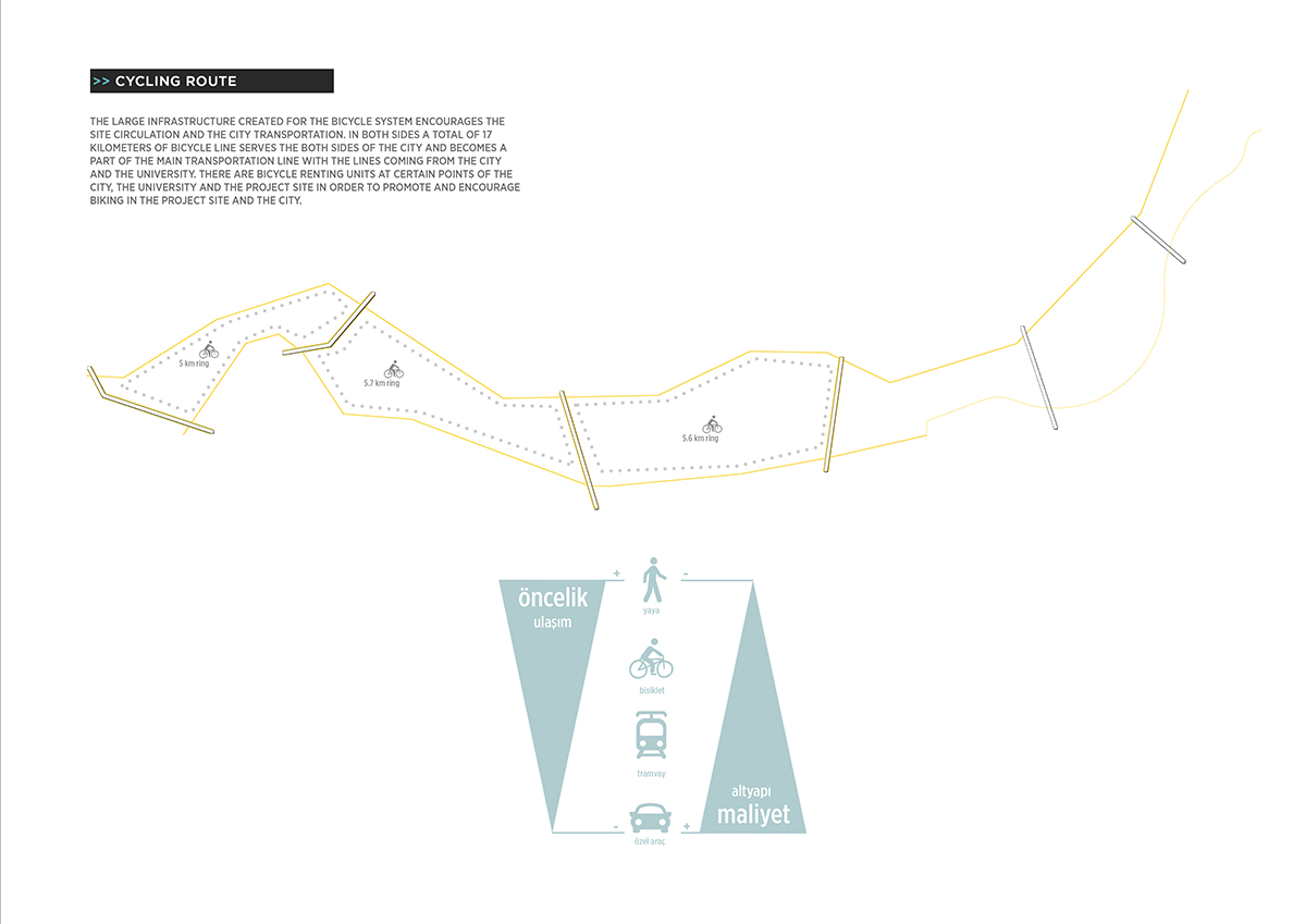
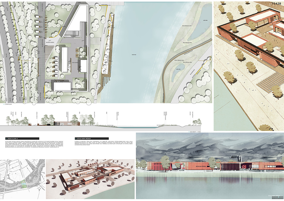
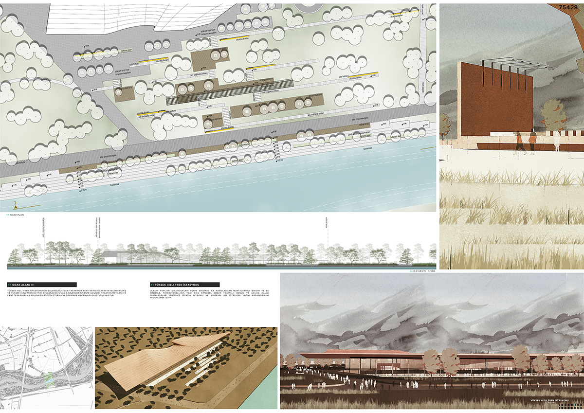
The masterplan consists of major functions including urban transport system and buffer zone, wetlands, city library, museum & art centre, high-speed train station, multi-purpose hall, sports facilities, recreational spaces, play areas for children, which were shaped through the 'islands' and their different architectural language.







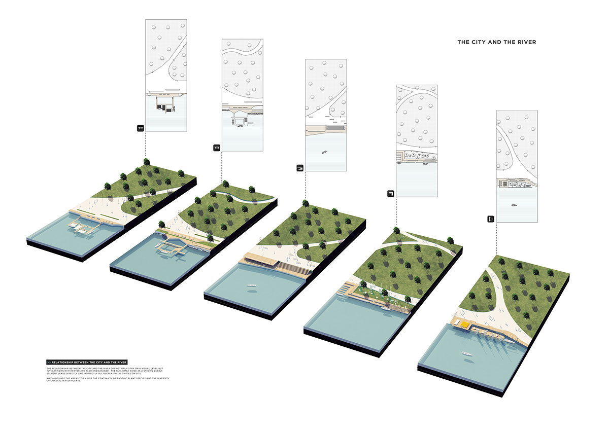
The city and river relation
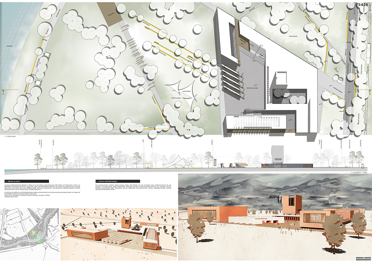
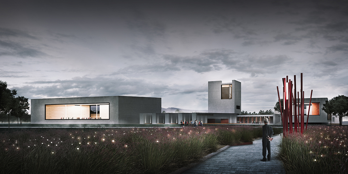
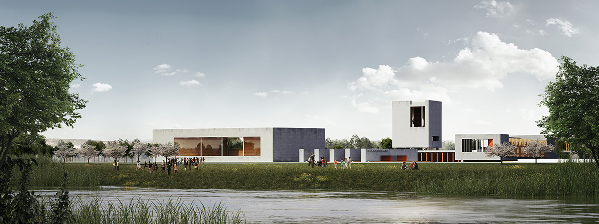



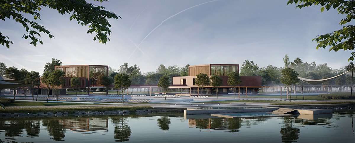
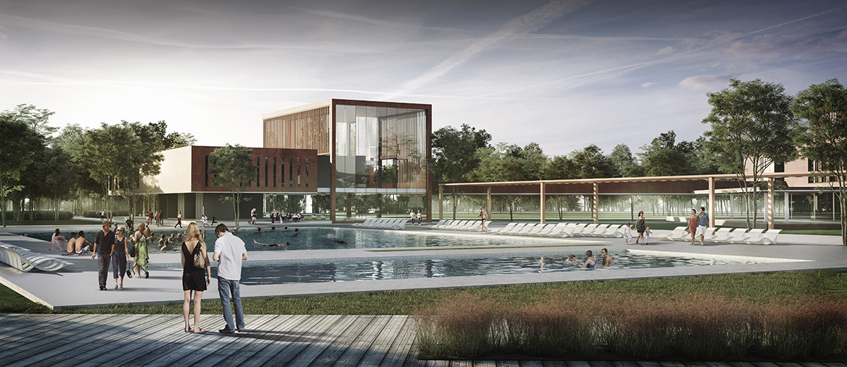

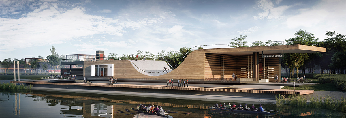
Water sports centre
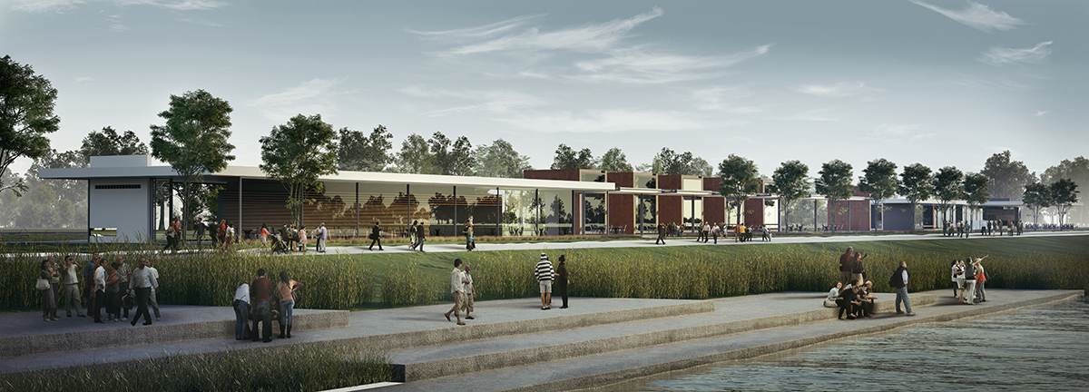
Restaurant
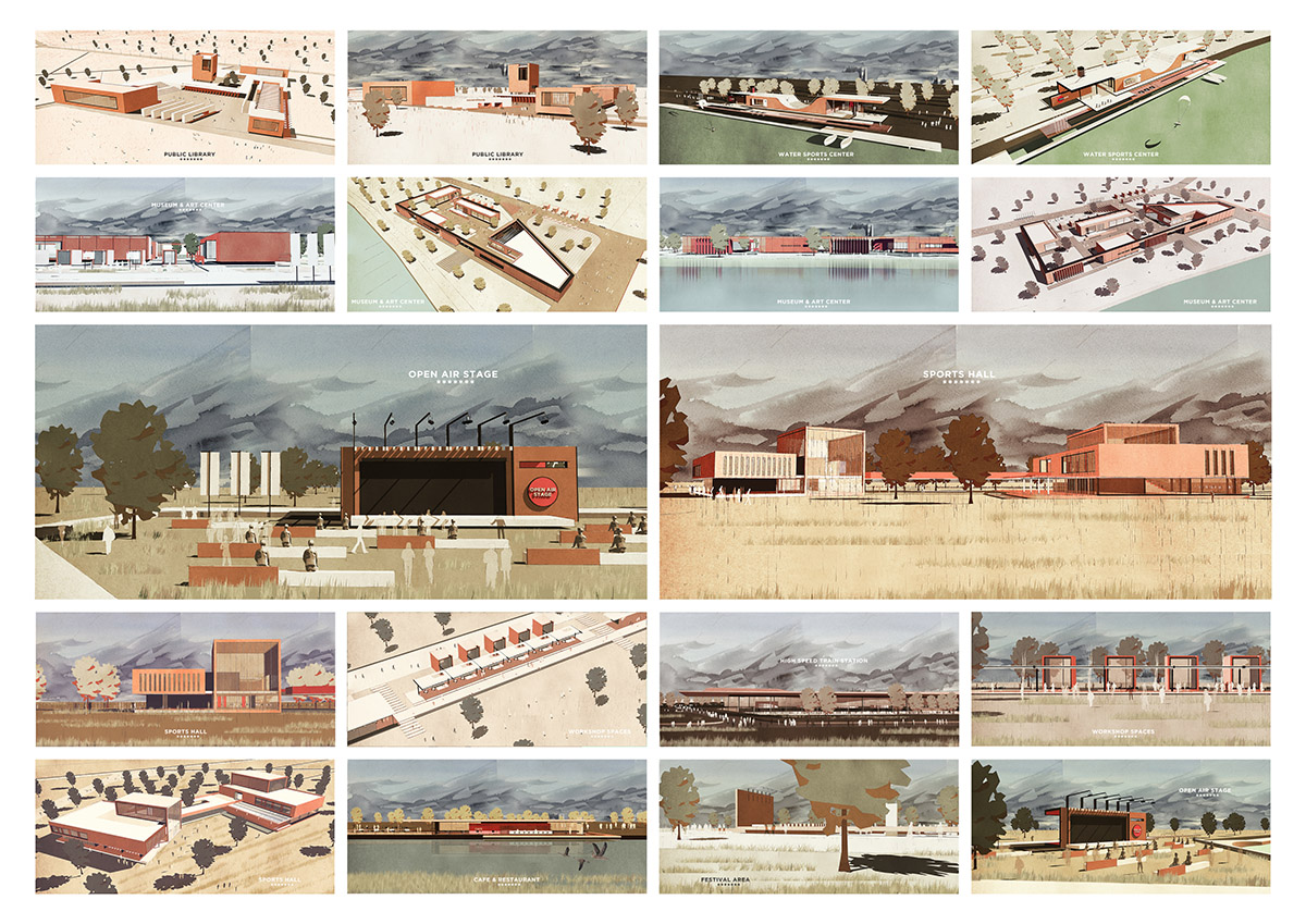
Architectural identity
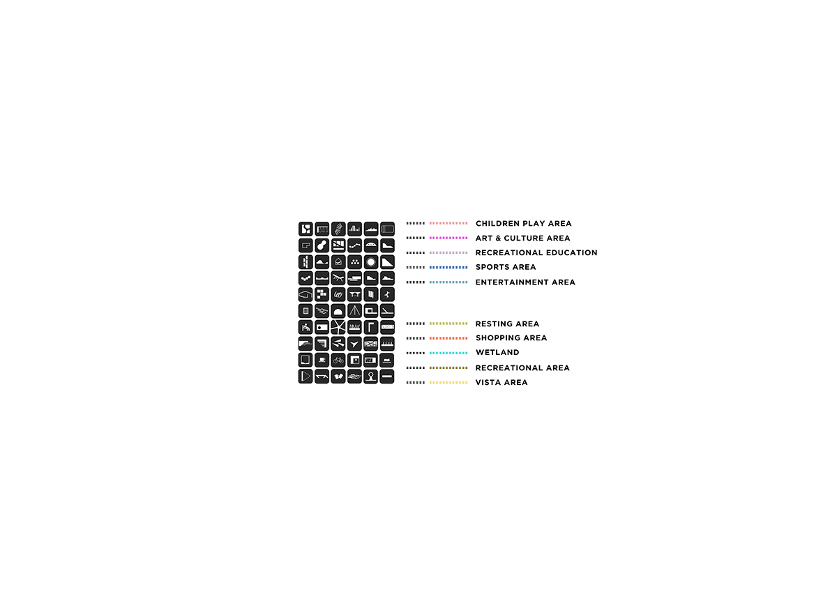
Legend
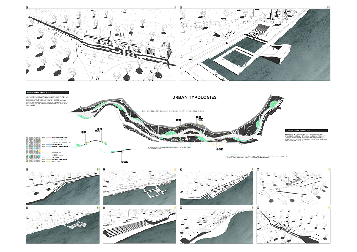
River Bank identity
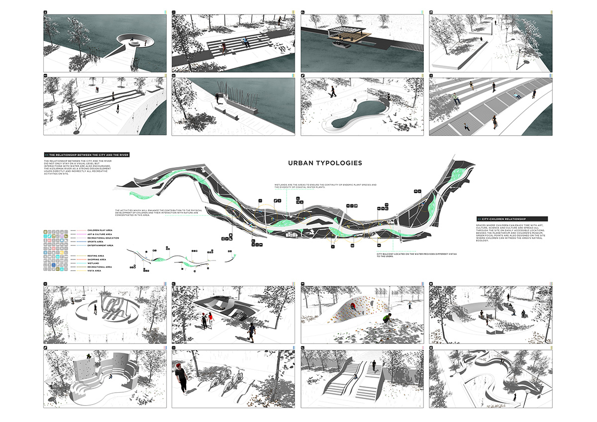
Urban identity / City-water & city-children
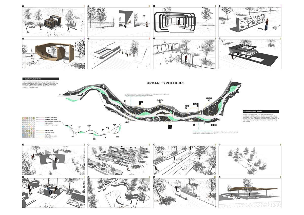
Urban identity -Cultural elements
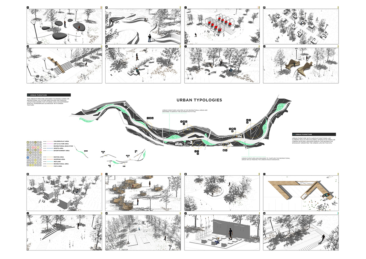
Urban identity-urban furnitures
ONZ Architects, led by Onat Oktem, won WA Awards in the 21st Cycle with Eco-Techno Park Green Building Showcase&Enterprise Hub project.
Project Facts
Architects: ONZ Architects + MDesign
Design Team: Onat Öktem, Murat Z. Memlük, Zeynep Öktem, Mehmet Çıkrık, Mehmet Feyzi Nilüfer, Sevgi Çalı, Melih Tokaç, Seda Özçelik Koç, Ebru Dehmen, Okan Mutlu Akpınar, Faruk Ünlü, Ayça Sapaz, Dilara Tuncer.
Location: Sivas, Turkey
Date: 2016
Consultants: Zafer Kınacı, Tuncay Demirci
Status: Competition
All images © ONZ Architects + MDesign
> via ONZ Architects + MDesign
