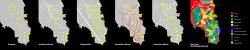
Attica suburbia
Athens constitutes a relatively thick and homogeneous urban net. The city itself is constricted within the Athens cirques boundaries. However the vast people-goods-information exchange networks spread beyond the borders of the city, in the whole of Attica region.
The Mesogeia valley and the Lavreotiki peninsula to the South sre a rather interesting case of urbanization. The urban character of these areas is not a part of the (usual) radial growth of Athens but derives from the various urbanity injections in places of significance. These can be large objects (i.e. terminals), small cities or scattered places of archaeological value. These hot-spots are interconnected with networks (existing or under construction) whilst the in-between space is a no-mans land, huge areas that are simply what remains betwwen the hot-spots. It is important to note that in the sea shores of the peninsula, resorts and holiday residences form a loose and wide urban net.
The aforementioned cities are interconnected via local networks, however the connection is truly visible in aerial views. The majority of the Lavreotiki peninsula cities lack a true connection with the main city as well as with each other.
Proposal overview
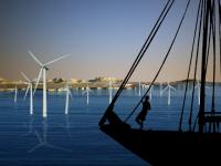
First, a new network is established that stabilizes and intensifies the connection of the hot spots. The net has a literal meaning – all hot spots are equal, none of them monopolizes networks and significant exchanges. The flow of people, goods and information is equally divided. Green areas are intensified, areas for agriculture and energy are singled out. Industrial uses are transferred in specific spots within a reasonable distance from residential areas and in a close vicinity to wind energy fields. A new port is created, or rather an old port is revived – thus, the two ports of Piraeus and Rafina service less sea routes and are more efficient. The valley is no longer a flat surface amongst mountain. Attica is no longer a space of networks – it is now a network space.
The case of Lavrio
The city of Lavrio has been widely known as the land of the silver mines since the ancient times but under-functioned in the modern era. During the 20th century, the mines reopened as lead, magnesium and cadmium were discovered. Needless to say that the city’s population boomed and that the environmental burden to the city and its sea front was magnified. Today the mines are no longer open. Raw materials are still left in piles across the land.
Proposal:
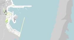
The proposal focuses in the reinvention of the Lavrio port. The port is redesigned, its coastline increased so as to serve the new needs of passenger and cargo ships. The new port has a capacity of 14 passenger ships, 4 cargo ships, 2 cruise ships and 238 smaller vessels. The natural geography of the sea front is intensified. The bay that is formed between Lavrio and the island of Makronisos (old exile land) is the ideal home to an important sea node. The coastline is enriched and redistributed. The functions are blended: residential buildings in the coastline, promenades along the cargo docks.
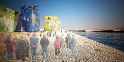
Two new wavebreakers signify the new port. The northern, almost perpendicular to the shore, stands for the future, hosting all the new terminals, start of the new journeys in tha Aegean. The second wavebreaker is parallel to Makronisos and stands for the past, the memory of the place. The pedestrians that walk along it experience the painful past of the exile island and the earth memories of the city itself – inside cavities are placed the 59 basic minerals of the place – a minor geological “museum”.
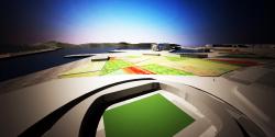
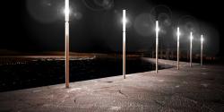
The coastline itself is affected by the earth memories – it resembles a crystal from the depths of the mines. Five multi-use buildings stand out like minerals, lighting the sea roads and reminiscent of the earth paths as well.
2008
2008
Dora Felekou