PROJECT BRIEF
PROPOSED CAGAYAN AUTOMATED DEEP SEAPORT
A 1,500-Hectare Deep-Sea Piling Offshore Container Terminal & Integrated Inland Logistics Hub
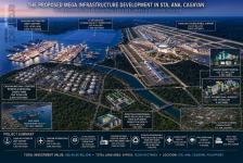
Part of THE PROPOSED MEGA INFRASTRUCTURE DEVELOPMENT IN STA. ANA, CAGAYAN
An AI-Driven Industrial, Logistics, Energy, Health & Education Mega Hub
______________________________________________________________
Location: Casambalangan–Port Irene, Santa Ana, Cagayan, Philippines
Proposed Port & Industrial Area: 1,500.0 Hectares total (900 Ha Offshore Piled Platform / 600 Ha Inland Zone)
Inland Zoning Fair Market Value Basis: ₱2,500.00 per SQM (Applicable strictly to the 600-Hectare Inland Estate)
Total Land Acquisition Cost: ₱15,000,000,000.00 (Fully absorbed within the overall project development package)
Baseline Infrastructure & Equipment CAPEX: US$9,758,064,516.13 (₱605,000,000,000.00 equivalent; Total Project CAPEX strictly capped at US$10.0 Billion Line Target)
Estimated Annual OPEX: US$750,000,000.00 per year (₱46,500,000,000.00 equivalent)
Planning Exchange Rate: ₱62.00 = US$1.00
Project Classification: Proposed Project of National Significance (PNS) and Special Economic Zone
Project Proponent / Local Industrial Partner: Rapid Technologies Development Inc.
Project Architect/ Conceptual Planner: Architect Hermenegildo C. Mercado, UAP
Proposed Ownership: 90% Foreign Direct Investor / 10% Rapid Technologies Development Inc.
Development Model: Foreign Direct Investment – Build, Finance, Own and Operate through an SPV
Project Status: Advanced Conceptual Development / For Board Evaluation and Investment Approval/ Not shovel-ready
EXECUTIVE SUMMARY
The Cagayan Global Gateway Corridor is conceived as an integrated Northern Luzon cargo, aviation, energy and trade platform linking the Proposed Cagayan Automated Deep Seaport, Proposed Cagayan International Airport, CEZA/Port Irene, renewable energy and industrial assets.
The seaport and airport are planned as a synchronized sea-air logistics gateway, supported by CEZA, the proposed 7.2-GW Cagayan Floating Solar PV Power Plant, BESS Smart Farm & Business Park and CNSERIEP.
The proposed FDI structure provides 90% foreign strategic-investor equity and 10% non-dilutable participation for Rapid Technologies Development Inc., subject to definitive agreements and Philippine law.
The Proposed Cagayan Automated Deep Seaport is an AI-driven international container and multipurpose deep-water port at Casambalangan–Port Irene, Santa Ana, Cagayan, designed to support CEZA, the airport, energy projects and Northern Luzon agricultural, industrial and manufacturing activity.
Core systems include automated container handling, AI port management, digital cargo tracking, smart warehousing, renewable-energy integration, BESS, shore power and electric cargo-handling equipment.
The preliminary development envelope is approximately 1,500 hectares. Ultimate master-plan capacity is up to 100 million TEUs/year, to be achieved through modular phases and validated by market, navigation, environmental and engineering studies.
Target CAPEX is US$10.0 billion, annual OPEX US$750 million and indicative annual revenue US$2.6 billion, with an indicative operating surplus of US$1.85 billion, 6–7 year payback and 15–17% target IRR. These are conceptual assumptions requiring validation.
A project SPV is proposed, with 90% foreign strategic-investor equity and 10% Rapid Technologies Development Inc. participation, subject to legal and transaction documentation.
The project remains an Advanced Conceptual Project—not shovel-ready. The sequence is board approval, land and legal due diligence, SPV structuring, financing, detailed design, approvals, procurement, construction, commissioning and phased operations.
The seaport is positioned as a strategic maritime gateway for Northern Luzon and the wider Pacific/Indo-Pacific trade network.The development integrates CEZA, Port Irene, the proposed airport, floating solar, BESS/industrial agriculture and CNSERIEP into a coordinated logistics and energy corridor. The commercial model combines automated port operations with diversified cargo, logistics, energy-interface and property-related revenues under the proposed FDI/SPV structure.
A. EXECUTIVE & STRATEGIC PROJECT FRAMEWORK
A1. Project Vision, Location & Strategic Positioning
Project Vision:
The Proposed Cagayan Automated Deep Seaport is intended to become the primary maritime transport, logistics, cargo trade, and commercial connectivity anchor of Northern Luzon. Its core purpose is to provide next-generation international connectivity across global cargo supply networks, heavy industry manufacturing distribution, bulk commodities trade, and modern automated logistics systems.
Strategic Location:
Situated inside the Casambalangan Corridor of Santa Ana, Cagayan, the site provides unparalleled direct proximity to the multi-billion dollar international trade zones and deep-water ocean pathways. It interfaces immediately with regional arterial road highways and proposed air distribution corridors via an integrated infrastructure spine.
A2. Strategic Role Within the Sta. Ana Mega Hub
The Seaport serves as the central logistics node of the proposed mega-development, feeding international cargo networks and specialized raw material requirements directly into every industrial layer. The overall strategic ecosystem operates as an unbroken loop:
[CAGAYAN AUTOMATED DEEP SEAPORT (Central Logistics Node)] -> [BRICS INTERNATIONAL UNIVERSITY] -> [CAGAYAN SMART HOSPITAL] -> [CNSERIEP ENERGY PARK] -> [CAGAYAN INTERNATIONAL AIRPORT] -> [CEZA / PORT IRENE]
Together, these components form the proposed AI-Driven Industrial, Logistics, Energy, Health & Education Mega Hub.
B. FACILITIES & TECHNICAL DEVELOPMENT
B1. Land Envelope & Campus Master Configuration
The proposed institutional land envelope comprises a Port & Industrial Area: 1,500.0 Hectares total (900 Ha Offshore Piled Platform / 600 Ha Inland Zone) of premium master-planned site. This expanded real estate envelope provides immediate balance-sheet asset value and ensures ample space for future phased berth expansion, automated yard blocks, and specialized port industrial parks without requiring immediate external land acquisition.
DEVELOPMENT BLOCK / PLATFORM PRIMARY LOGISTICAL FUNCTION
Marine Berth & Quay Interface Core vessel loading/unloading, automated quay cranes (AQCs),
and deep-water navigation access
Automated Yard & Container Stack Robotic automated stacking cranes (ASCs),
AGV navigation grids, and container asset tracking
Port Logistics & Smart Warehousing E-commerce processing, customs inspection zones, and
high- density automated distribution warehouses
Industrial & Manufacturing Zone Export-oriented manufacturing plants, light industrial assemblies,
and value-added trade processing
Cold Chain & Agricultural Export Temperature-controlled agricultural bays, flash-freezing nodes,
and perishable food export logistics
Utilities / BESS / Energy Zone Smart utility microgrids, LNG/Energy berth interfaces,
high-voltage substations, and wastewater treatment
Future Expansion Reserve Strategic land allocation reserved for long-term Phase 4
and 5 terminal capacity extensions
2026
- PROJECT IDENTIFICATION & INVESTMENT SNAPSHOT
Development Context:
The underlying Smart Port operating model identifies annual marine and yard personnel payroll, offshore infrastructure maintenance, advanced security monitoring, automated container yard software licensing, terminal energy draws, and deep-sea piling structural integrity monitoring as major components of seaport OPEX. The reconfigured 1,500-hectare footprint provides an optimized, hyper-efficient structural layout split into a 900-hectare deep-water offshore container terminal and a 600-hectare inland industrial processing park. The total US$10.0 Billion development CAPEX accounts for the comprehensive construction envelope, automated marine equipment arrays, and inland land acquisition to ensure complete fiscal transparency.
ITEM PROJECT BASIS
Project Name Proposed Cagayan Automated Deep Seaport
Project Positioning Deep-sea piling offshore maritime gateway, global container transshipment
hub, and master-planned inland industrial aerotropolis zone
Development Context Part of the Proposed Mega Infrastructure Development in Sta. Ana, Cagayan
Location Casambalangan–Port Irene, Santa Ana, Cagayan, Philippines
Total Project Footprint 1,500.0 Hectares total (9,000,000 sqm Offshore / 6,000,000 sqm Inland)
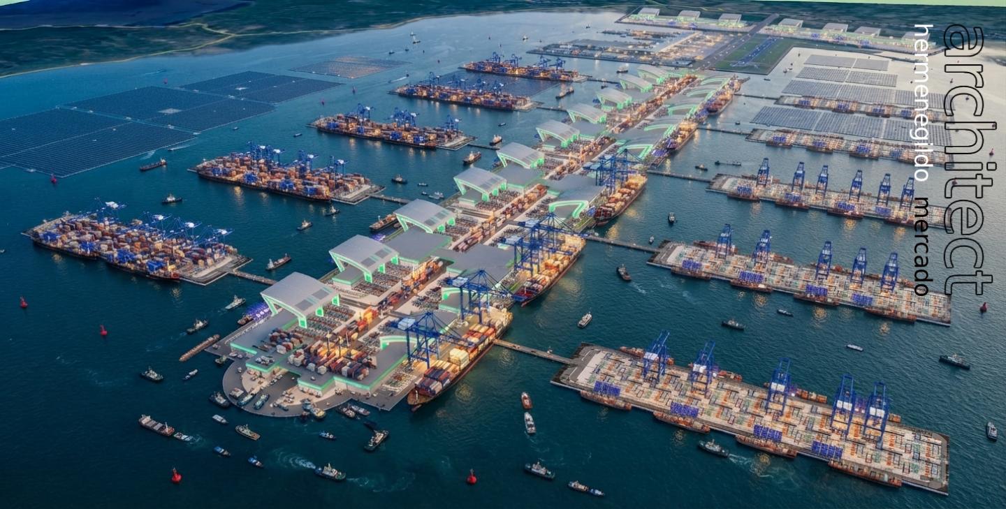
Offshore Engineering Model No Land Reclamation. 900-Hectare platform supported by deep-sea
structural piling
Inland Component 600-Hectare industrial park, smart logistics zones, and export processing areas
Gross Floor Area Approximately 450,000 sqm (Inland Logistics Districts, Customs
Gates & Terminal Complexes)
Handling Capacity Conceptually supporting up to 100 Million TEUs per year ultimate
master-plan build-out capacity
Employment Generation Direct employment generator for 100,000 direct and 250,000
indirect regional positions
Personnel / Crew Approximately 15,000 total administrative, technical, safety
and automated yard operators at stabilized scale
Development CAPEX, excl. land US$9,758,064,516.13 / ₱605,000,000,000.00
Land Acquisition Cost ₱15,000,000,000.00 / approx. US$241,935,483.87 (Strictly for the
600 Ha inland footprint, included inside CAPEX cap)
Total Investment incl. land US$10,000,000,000.00 (Strictly US$10.0 Billion Line Target
/ ₱620,000,000,000.00)
Reference Annual OPEX US$750,000,000.00 / ₱46,500,000,000.00 per year
Planning FX / Designer ₱62.00 = US$1.00 / Architect Hermenegildo C. Mercado, UAP
DEVELOPMENT PARAMETERS & SPATIAL ALLOCATION
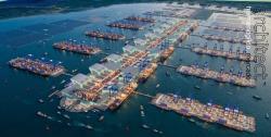
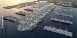
The proposed seaport footprint spans an optimized 15,000,000 square metres (1,500.0 hectares), re-engineered into two distinct spatial zones to eliminate coastal land reclamation. The 900-hectare offshore platform features a distinct, aerodynamic layout designed by Architect Hermenegildo C. Mercado, UAP, resting on specialized deep-marine foundation piles. This offshore structure is seamlessly connected to the 600-hectare inland manufacturing and customs zone via an enclosed intermodal transit spine.
ZONING LAYER / DEVELOPMENT SEGMENT ALLOCATED PARAMETERS (1,500 HA TOTAL ENVELOPE)
OFFSHORE COMPONENT (Supported by Deep-Sea Piling) 900 Hectares Total Matrix
- Container Terminal & Automated Berth Lines 500 Hectares
- Multipurpose / Bulk Cargo Platform 150 Hectares
- Port Administration, Tech Zone & Control Tower 50 Hectares
- Offshore Energy Berth Interface & Utilities Platform 100 Hectares
- Marine Maneuvering Buffers & Staging Decks 100 Hectares
INLAND COMPONENT (Onshore Land Bank) 600 Hectares Total Matrix
- Export Processing & Light Industrial Park 250 Hectares
- Port Logistics & Smart Warehousing Complex 150 Hectares
- Trucking, Inland Container Depot (ICD) & Customs Gate 100 Hectares
- Roads, Right-of-Way Spin, Drainage & Green Buffers 70 Hectares
- Future Inland Expansion Reserve 30 Hectares
E. INVESTMENT, OWNERSHIP & LAND STRUCTURE
E1. SPV, Joint-Venture Options & Ownership Framework
To accommodate corporate capital parameters, Rapid Technologies Development Inc. (RTDI) presents two structured transactional entry pathways for the pre-development phase:
Pathway Option A (Joint-Venture Development SPV):
The investor acquires the 600-hectare inland land footprint at the baseline rate of ₱2,500/SQM (totaling ₱15,000,000,000.00 or US$241,935,483.87) and structures a 90/10 corporate split. The investor holds 90% equity control, assuming absolute operational revenue management, downstream detailed engineering drawing services (DAEDS), and building CAPEX. Rapid Technologies Development Inc. retains a 10% non-dilutable free share as the Industrial Partner, taking responsibility for local licensing, port zoning conversions, and national maritime regulatory compliance layers.
Pathway Option B (Independent Land Bank Purchase):
The investor purchases the 600-hectare inland infrastructure asset directly as a standalone, unencumbered corporate property bank under 100% solo ownership, with complete autonomy to develop, lease, or land-bank at their own pace, entirely free from joint-venture carries or partner carry-backs. Development rights for the 900-hectare offshore piling platform are transferred fully to the investor under long-term maritime concession mechanisms.
E2. Landownership, Title Subdivision TCT Gates & Escrow Mandate
Upon execution of the legally binding Memorandum of Agreement (MOA), the inland transaction triggers via a clean, unified clearing structure:'
Downpayment: A one-time 30% lump-sum Downpayment of ₱4,500,000,000.00.
Balance Terms: Twelve (12) structured Post-Dated Checks (PDCs) dividing the remaining 70
hcm hcm