Urban Revitalization and Territorial Integration
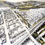
This project addresses the concept of Integral Habitat by restoring the degraded boundaries between three cities, fostering social and territorial integration. Through a large green corridor, a tram system, and the creation of sustainable urban spaces, connectivity is improved, creating a safe and balanced environment.
Additionally, the intervention includes an administrative-residential complex that provides shelter for vulnerable populations, promoting inclusion and harmonious urban development. The proposal transforms a conflict-ridden area into a dynamic meeting point, where infrastructure and landscape reinforce social cohesion and quality of life.
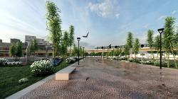
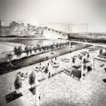
Uncontrolled urban growth and a lack of coordination between these cities have left the area abandoned, with underutilized spaces, polluted canals, and mobility issues. This project seeks to reverse that situation by creating a green corridor that connects the cities, promotes sustainable transportation with trams, and generates spaces for community interaction.
The administrative-residential complex will provide housing solutions and essential services to the most vulnerable population, fostering equity and inclusion. The intervention will reclaim public space, improve environmental quality, and strengthen mobility, transforming a degraded area into a safe, accessible, and sustainable environment.
The initiative is based on the San Miguel de Tucuman Master Plan, which focuses on revitalizing deteriorated urban areas and promoting territorial integration. It will connect San Miguel with Manantial and Yerba Buena through a green corridor, trams, and a residential-administrative complex, aligning with municipal strategies to enhance mobility, security, and urban sustainability.
Furthermore, it complements previous regeneration efforts led by the municipal government and local stakeholders. The proposal aims to coordinate existing and future actions, strengthening social cohesion and improving the quality of life in the region.
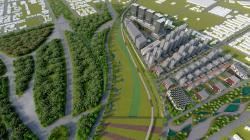
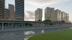
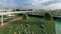
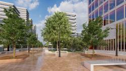
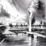
The project transforms Canal Sur and the diagonal into an axis of integration, mobility, and sustainability. Currently, this area is a hotspot for waste, insecurity, and marginalization. The proposal establishes a green corridor with alternative transportation through trams, connecting isolated sectors and creating a safe and accessible environment.
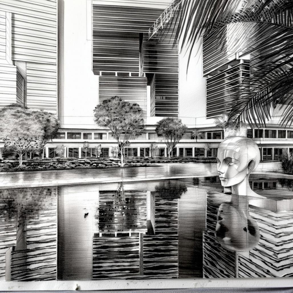
Additionally, the administrative, commercial, and residential complex will provide housing solutions for vulnerable populations, turning a degraded urban boundary into a new development center. In doing so, the intervention revitalizes the area, fosters social cohesion, and promotes equitable and sustainable urban growth.
Sustainability and Environmental Impact
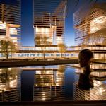
The proposal aligns with the principles of LAIF City Life by comprehensively addressing urban regeneration, social inclusion, financial viability, and environmental sustainability. Its design prioritizes the integration of the three cities through a green corridor, a tram system, and an administrative-commercial-residential complex, strengthening connectivity and equitable access to opportunities.
From an inclusion perspective, the project will benefit over 500 vulnerable families, including female heads of households, unemployed youth, and elderly adults. The beneficiary population is diverse, with a high proportion of people at risk of social exclusion. Their participation will be key in the project’s design and management through community workshops, dialogue tables, and surveys.
Additionally, labor inclusion will be promoted in the construction and maintenance of the green corridor and the residential-administrative complex. The intervention will ensure equitable access to housing, transportation, and public spaces, improving the quality of life for these communities.
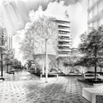
The proposal promotes compact urban development by revitalizing a degraded area without expanding the city in a dispersed manner. Underutilized land at the boundaries of the three cities is repurposed, optimizing existing infrastructure and reducing pressure on peri-urban areas.
The residential-administrative complex will have a density of 250 inhabitants per hectare, integrating housing, commerce, and services to encourage mixed land use and minimize the need for long commutes.
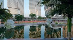
The tram system within the green corridor will replace the mass use of vehicles, reducing the carbon footprint and decreasing pollution in the region. By integrating with the green lung, it will improve air quality and biodiversity, creating a healthier environment. This sustainable mobility, combined with urban land regeneration, will strengthen environmental resilience and mitigate the urban heat island effect, benefiting the entire population.
Climate Change Mitigation and Adaptation
The project contributes to climate change mitigation and adaptation through sustainable mobility strategies, energy efficiency, and environmental regeneration. The implementation of an electric tram within the green corridor will significantly reduce CO₂ emissions by decreasing the use of combustion vehicles. Additionally, the green belt will absorb carbon and improve air quality, enhancing biodiversity with native vegetation.
The residential-administrative complex will incorporate bioclimatic architecture principles, including cross-ventilation, green facades, and low-impact materials, reducing energy demand. Solar and wind energy will be promoted to power public lighting and buildings.
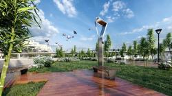
Regarding waste management, a community recycling and composting system will be implemented, minimizing waste and fostering a circular economy. Additionally, the design will optimize water management with rainwater harvesting systems and sustainable drainage, adapting to extreme climate conditions and ensuring urban resilience.
2024
Urban Intervention Technical Report
General Project Description
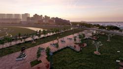
The project proposes the revitalization of a degraded urban boundary between three cities through the creation of a green corridor with trams, public spaces, and an administrative-commercial-residential complex. The intervention covers a total of 12 km of urban edge, benefiting more than 500 vulnerable families.
Infrastructure and Land Use
The master plan is designed under a compact development scheme, optimizing land use and avoiding the city's dispersed expansion. The land use distribution is as follows:
Residential zone: 45% of the total area, with a density of 250 inhabitants/ha.
Commercial and administrative zone: 30% of the area, designated for government offices, businesses, and services.
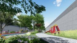
Public spaces and green areas: 25% of the area, including parks, plazas, and pedestrian corridors.
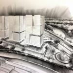
Features of the Administrative-Commercial-Residential Complex
The complex will consist of mixed-use buildings with the following characteristics:
Average height: 6 to 10 levels, with an FOS (Floor Occupation Factor) of 60% and an FOT (Total Occupation Factor) of 500%.
Housing: Units of 45-90 m², designed under bioclimatic architecture principles.
Offices and businesses: Modular spaces of 50-150 m², adaptable to various economic activities.
Community spaces: Meeting rooms, citizen service centers, and coworking areas.
Mobility and Sustainable Transport
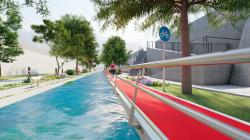
Tram: 12 km system with stations every 800 meters, capacity for 300 passengers per unit.
Pedestrian and bicycle network: 40% of the road space designated for non-motorized mobility.
Integrated public transport: Connection with bus lines and strategic stops at urban nodes.
Sustainable Materials and Technologies
Construction: Use of low-carbon concrete, recycled steel structures, and prefabricated materials.
Energy: Photovoltaic solar panels on rooftops, wind power generation at strategic points.
Water management: Rainwater harvesting and greywater recycling systems.
Thermal efficiency: Green facades, thermal insulation, and cross ventilation in buildings.
Student: Víctor Alfonso Montañez
Collaboration of Architect: Vanesa Carolina Busi
Teacher: Architect Patricia Rodrigues Anidos
Victor Alfonso Montañez