Ashapura Institute of Shipping Management {AISM} – 1996
The site is located in a predominantly institutional-residential corridor along the Bhuj-Mundra Highway 10 Km from Bhuj. The site is in two parcels, one of 17 acres and the other of 8 acres. The larger chunk of 17 acres lies between two monsoon streams, and the other 8 acre parcel abuts the edge of one of these streams.
The program includes teaching, support, and all living facilities for staff and students. A total of 240 students and 30 faculty are expected after completion of all three phases. The total residential population will be about 450 persons including faculty and staff families. Occasionally there will be about 500 visitors for use of the civic facilities at the institute.
The landscape of the region is typically mud flats between ridges concealing a deep water table. Once submerged by sea, much of the land is saline with the only source of fresh water being a 3000 year old water table beneath the Bhuj ridge. Due to intensive use over recent years the level of the water table has sunk rapidly, with little thought given to channeling rainwater back to the water table or putting it to use on the surface. In this setting - a climate severe on its human inhabitants and a landscape in need of repair that the question of dealing with waters both culturally and ecologically is central. The intention at the AISM is to unite building and landscape in a manner where the building can complete and repair the landscape by positively channeling the monsoon water into harvesting ponds whilst providing comfort and orientation to its inhabitants in their day to day learning and living. The aim is to design an eco system of landscape and buildings where each asserts its own presence whilst supporting the other.
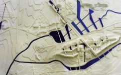
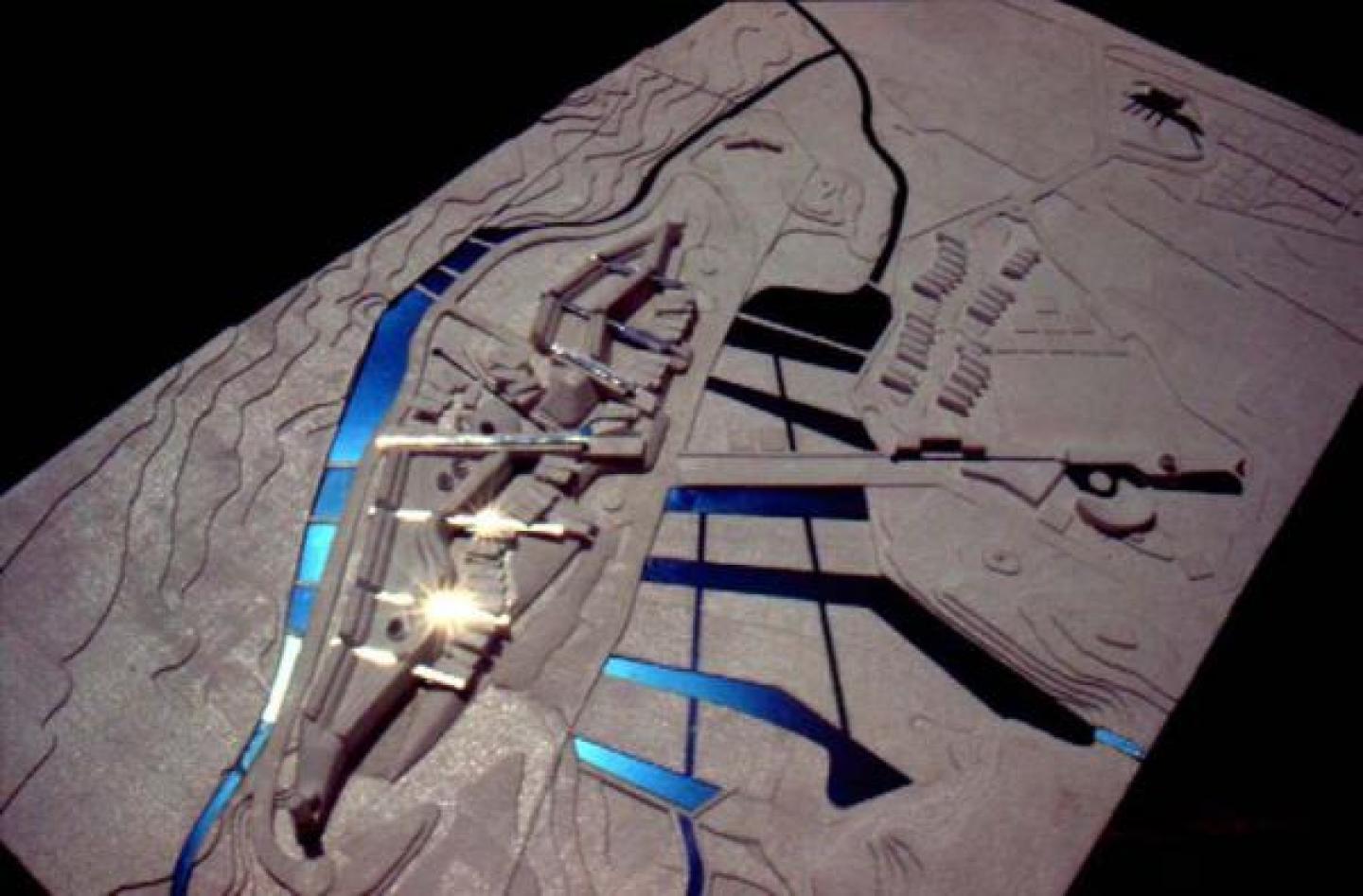
Over the landscape of ridge and watershed we superimposed the concerns of shelter and connection in the form of shells cut into the valley walls that are joined by bridges. Thus the buildings, conceived of as ridges cut into the hillside, order the movement of rainwater and people across the site in a way which orients and shelters human life and maintains the natural watershed to help reestablish plant and wildlife diversity in a self sustaining manner.
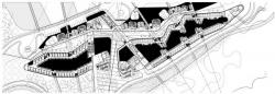
BRIDGES AND ROUTES : To physically respond to the valley and spatially structure the Institute `radiating bridges` have been used. The frequency of the bridges is determined by the demand of stair cases and fire egress points. The `bridges` are in reality a light framework which span across the valley but the routes within them stretch between the various facilities they contain and connect. They will provide support to many practical functions, eg. Retaining walls, storage, aqueducts, raised walkways, placement of solar plate collectors as well as routes for all services and the placement of toilet blocks and fire stairs. They also spatially organise different activity areas with the valley by forming a series of inter linked courts. The bridges are conceived as sculpture within the site, and could be interpreted in several ways by artists and sculptors. Pieces of `the bridge or route` may appear as signs or traces within the streetscape of the valley.
VALLEY : The 17 acre parcel of land zoned for the institute is topographically cleft into two from north east to south west by a valley. This natural topographic element has been used to physically structure the Institute to express a natural hierarchy of public and private life. The northern edge of the valley forms the academic zone whilst the southern edge consists of the student residential facilities and its necessary ancillaries like the common rooms and dining halls etc. The valley is oriented to catch and funnel the prevailing south western breeze through the interspersed recycling pools of water, fountains, sprays, mists, sculpture courts and dry landscape arbours, cooling the entire campus and forming a unique walk linking the vari
1996


.jpg)