Urla, once a thriving agricultural hub, is now facing a critical transformation. The fertile lands that have sustained their social, cultural, and economic fabric for centuries are rapidly diminishing due to the pressures of urbanization, tourism, and increasing second-home developments. As agricultural incomes decline, local farmers are forced to sell their lands, eroding the region's agrarian identity.
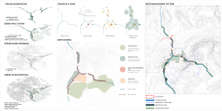
At the heart of Urla's changing landscape lies the Akpınar Stream, which has historically shaped the town's physical and social divisions. More than just a waterway, the stream served as a cultural boundary, with Muslims residing on its eastern bank and Greeks and other ethnic groups on the western side. Over time, this geographical divide reinforced a social distinction. Though the population shifted following the population exchange, Akpınar Stream remained a vital element of Urla's identity. However, as urbanization progressed, the stream was encased in concrete to prevent flooding, and today, due to climate change, it has dried up. Once vibrant and ecologically rich, the stream's banks have been overtaken by traffic and disconnected from the urban fabric, leaving behind a lifeless channel.
The loss of both agricultural land and the stream's natural character highlights a pressing issue: the need to restore harmony between urban life and nature. Cities should not consume their natural surroundings but rather coexist with them in a mutually beneficial relationship. As Jane Jacobs once said, "A city is an organism—complex, dynamic, and constantly evolving." With this understanding, a comprehensive revitalization project has been initiated to reintegrate Akpınar Stream and its surrounding agricultural lands into Urla's urban structure.
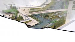
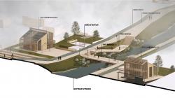
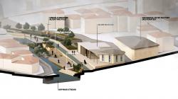
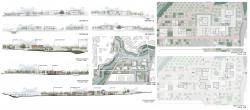
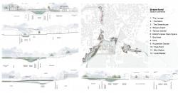
This project involves restoring the stream's natural form by replacing the concrete channel with permeable surfaces and reintroducing water-retaining plants. Flood risks have been mitigated by widening the streambed—wider&shallow in the south and narrower&deeper in the north—while restoring the ecological balance. Vehicle traffic along the stream has been minimized, making way for a pedestrian- and bicycle-friendly promenade featuring amphitheaters, terraces, and viewing platforms. To ensure the continuity of green spaces, parks, urban gardens and recreational areas have been integrated into the new layout, reconnecting the city with its natural heritage.
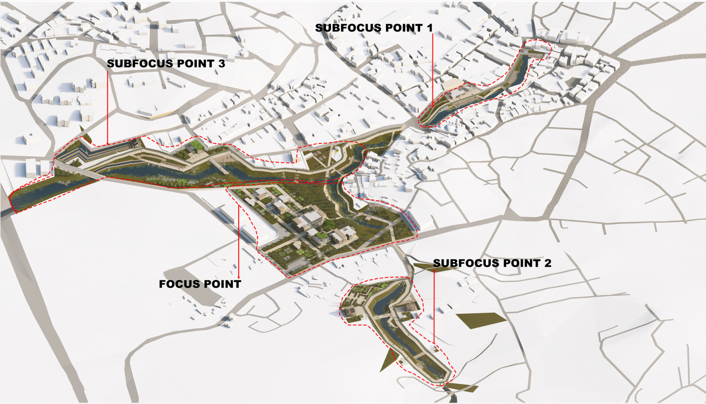
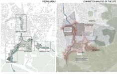
The revitalization effort is structured around four key focus areas:
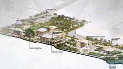
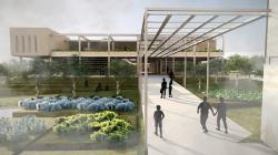
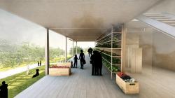
Main Focus Area: This remarkable location is where the river gracefully splits into two branches, embracing the historic Urla Dam. It stands as a vibrant focal point at the crossroads of urban and agricultural landscapes. An innovative agricultural research and development center has been created to inspire and elevate agrarian production.
First Sub-Focus Area: Located at the northern entrance of the city's historical core, this zone serves as the project's most prominent front, enhancing the connection between historical and contemporary elements.
Second Sub-Focus Area: Agricultural fields along the river border this transitional zone, bridging rural and urban spaces while integrating agrarian production into the overall spatial organization.
Third Sub-Focus Area: Found at the southern entrance, this area acts as a critical transition point, defining the boundary between urban development and agricultural land. It welcomes both urban visitors and local rural residents.
This bold intervention strategy aims to preserve Urla's historical and natural heritage while reshaping urban life to harmonize with nature. Akpınar Stream, once a forgotten relic, is now being transformed into a thriving green corridor, ensuring a sustainable future for Urla and its people.
2025
Property Categorization
Collaboration Zone: This initiative involves collaboration with local landowners to promote sustainable agricultural practices by establishing a product marketplace and ensuring direct procurement of their produce. This approach empowers farmers and fosters a resilient community through cooperative efforts.
Purchase Zone: The objective is to acquire land and properties, including those in the Akpınar stream buffer zone, and offer property owners equivalent plots from state or municipal land.
25-Year Lease Zone: This zone focuses on leasing land from owners for 25 years to construct sustainable agriculture research and development centers utilizing circular construction methods. After the lease period, the contract will be renewed if there is ongoing demand for these facilities; otherwise, it will be allowed to expire. This strategy promotes innovation, collaboration, and sustainability while providing the flexibility to adapt to future needs.
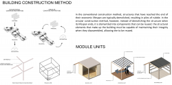
Construction Method
In conventional construction models, structures that have reached the end of their economic lifespan are typically subjected to demolition, resulting in significant quantities of rubble. Conversely, the circular construction model advocates for disassembling structures at the end of their lifecycle, allowing components to be reused rather than disposed of. The structural elements must retain their integrity during disassembly to facilitate reuse. The use of a steel structure within this project underscores its sustainability while enhancing the overall design's strength and durability.
Designers: Zehra Öztürk, Beril Bostancıoğlu, Senem Biçer, Destina Karpat
Supervisors: Ar. Gör Merve Ayten Kılıç, Dr. Öğr. Üyesi Nicel Saygın
