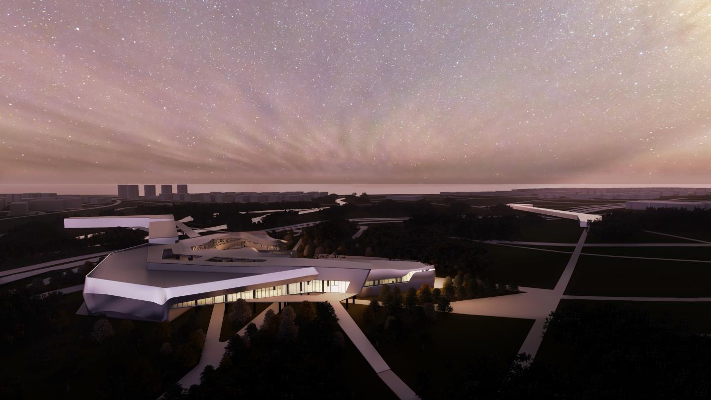
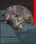
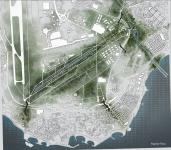
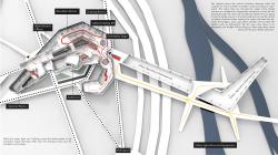
The main focus of the project is natural disasters that are affecting İstanbul province and providing solutions that would minimize the damage afterwards. The selected area is Bakırköy, which is a high hazard earthquake zone, is also in danger of flooding of Ayamama Creek passing through the district. To achieve public consciousness about natural disasters, what to do at the time of a phenomenon and the outcomes, a Disaster Prevention and Education Center is going to be located in between the Ayamama Creek and Atatürk Airport. Atatürk Airport was the biggest airport in İstanbul, which is moved to another location. Thus, the enormous area where the airport used to be located remains unused.
In the proposed disaster prevention center, people will be able to experience certain simulations or participate in seminars on the natural disasters. In an urban scale, the project aims to rejuvenate Ayamama Creek by landscaping and offer strategic solutions for possible disaster scenarios. Bakırköy is a district on the European side of İstanbul. The province has a residential character and highly populated, mostly inhabited by upper middle class. Bakırköy is a large municipality that also includes neighbourhoods such as Yeşilköy, Ataköy and Yeşilyurt. Bakırköy is easy to reach with both public and private transportation. One of the most important circulations roads of İstanbul, the E-5 highway is also located on the area. The district has a coast to the Sea of Marmara. The ferry boats are available from the coast, that takes passengers to the Asian side of the city: Kadıköy and Bostancı. It is also possible to take a ferry to the Adalar (Islands). Along with the water transportation, the district is on the line of a suburban railway between Halkalı and Sirkeci. Moreover, there is a subway line from the old Atatürk Airport zone to Aksaray is present on the province and a metrobus stop (Yenibosna).
The most recent major seismic activity in Turkey happened in October 2020, affected İzmir and its nearby cities the most, leaving a lot of people homeless and caused death of many. One devastating earthquake was in August 1999, near Kocaeli. The event lasted for 37 seconds and killed 18,373 people, also generated a tsunami which was 2,5 meters high that killed 155 people, and overall left at least 250,000 people homeless. The most destructed district in İstanbul was Avcılar, since it is built on a weak ground, mainly “poorly consolidated Cenozoic sedimentary rocks”. This situation makes the area unsafe in an event of earthquake. According to the seismologists, İstanbul is under the risk of an earthquake with a magnitude of at least 7,6 before the year of 2030 with a possibility rate more than %60. However, the incremental increase of the population in İstanbul is raising the devastation risk after a disaster. Despite the popularity of the subject by the warnings of authorities, people are not thoroughly ready for the phenomenon. The chosen location for the project is Bakırköy, which is next to Avcılar district mentioned before. The area is a high hazard earthquake zone because of its proximity to the fault lines. After 1950s, İstanbul’s population highly increased due to massive migrations. This situation caused illegal housing around the neighbourhood. In a similar manner, many industrial facilities and factories had been constructed nearby the stream which distrupted the richness of the creek and lead to high amounts of pollution. Today, the pollution causes not only smell but also certain diseases that puts the health of the people in the neighbourhood under risk because of certain types of bacterias.
2020
2020
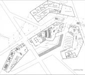
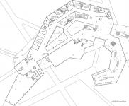
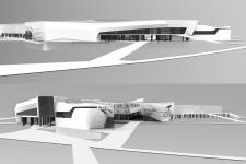
Project Location: İstanbul/Bakırköy.
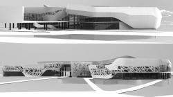
The project contains 4 masses on the ground floor level seperated by each other, circulated by outdoor paths. On the ground level, there are simulation rooms, multi-purpose hall, an auditorium, 4D video display rooms, a cafe, seminar rooms, library, open air exhibition space and foyer. All of the masses have their own lobby to serve the seperated functions of the masses for the usage of different user profiles. The technical volumes and storages are on this level and the floor beneath it (-3.00). On the upper floor (+4.80), all 4 of the masses are connected with one of the main bridge structures. In this floor, there are offices, simulation rooms, exhibition hall and orientation stage. The visitors coming from the bridge are using this entrance to the complex, circulating from the orientation stage to the simulation rooms.
İdil Dursun


Favorited 2 times