In a technology driven world, we often forget about the seemingly intangible atmospheres that unify man and machine. As we experience a paradigm shift in transportation technology, this project sought to understand how the current urban streetscape will be influenced by airspace as well as explore the opportunity to design beyond the streetscape and into uncharted territories of our urban environment. In pursuing how and what the future of urban transportation will become, we must also understand how to intentionally design for the invisible atmospheres that surround us. The objective of ‘Airspace’ was to reveal the unseen spaces of our atmosphere and celebrate the qualities they offer humanity with a focus on air’s presence in transportation technology and urban transit design.
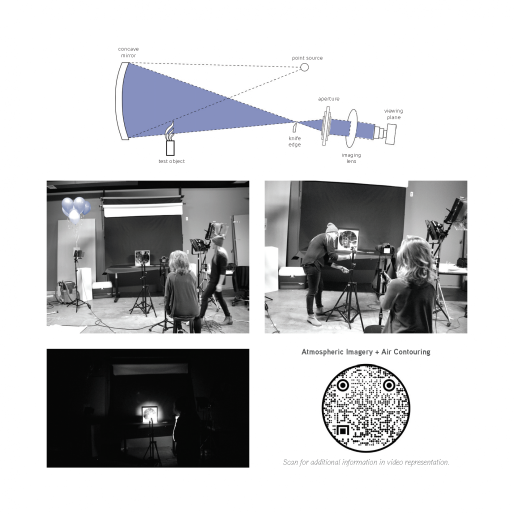
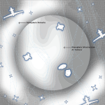
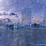
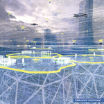
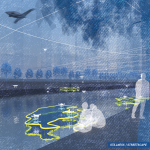
In order to create an attainable design for the mobility of “tomorrow” it is necessary to establish not a single fixed site, but a site whose presence surrounds the inhabitants of Earth at all moments of life. Understanding air as a physical location was crucial for this project as this weightless environment has the unique capability of emphasizing a shift away from congested travel networks and towards those that are spatially organized, as well as offering a sense of emotional connection. In addition to establishing this site, three territories within Chicago’s airspace were chosen to further focus on; Downtown Chicago, Monroe Harbor, and Midway Airport — each offer a unique transportation typology which is essential to understanding their specific atmospheric qualities and future design implications. This project closely examined airflow studies and the direct impact such airflow has on atmospheric transportation. In order to understand the unseen qualities and infrastructures of airspace, a composition of physical and digital models was produced using flow visualization techniques and computational fluid dynamics (CFD) studies. These methods were done to establish a better understanding of environmental conditions and their direct relationship with the four altitude zones that this project has pursued: streetscape (0-165ft.), low-altitude (165-650ft.), roofscape (650-1650ft.), and high-altitude (1650-3500ft.). Through these visual studies, three atmospheric conditions were determined. These conditions have been defined as turbulence, flux, and stillness. After studying these conditions, a series of air contours were produced. In generating these air contours, the natural topography that each atmospheric condition offers were able to be discovered. The contouring of these atmospheres allowed for physical presence to be created out of these otherwise intangible atmospheres.
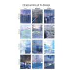
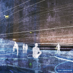
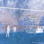
Our streets are more congested than ever before, and with the advancements in air transportation our skies are not far behind. This project has taken great strides in creating ways in which air itself can be represented through different mediums, and in doing so facilitates the discovery of unseen infrastructures that exist within these atmospheric conditions. The boundaries between seen and unseen are being continuously blurred as the new infrastructures of “tomorrow” take shape. Within these infrastructures, moments of turbulence, flux, and stillness have been created. Each of these moments take shape to their true atmospheric conditions as they attempt to not only celebrate airspace itself but simultaneously emphasize the need for public acceptance and airspace integration as we enter a dynamic shift in transportation technology. These moments strive to evoke an emotional connection between user and air, and in doing so create architectural spaces of “tomorrow.” The air travel of “tomorrow” is here, and we have a collective responsibility as designers to not let such space become, once again, a wasteland of congested travel paths and a dead space enclosed by the structures that multiply around us. This liminal airspace demands architecture that activates the wondering senses of humanity.
2020
2021
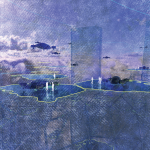
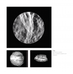
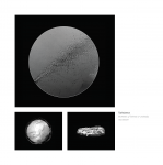
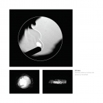
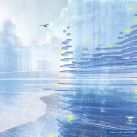
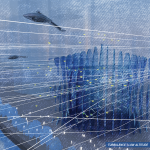
The flow visualization methods that this project produced were crucial to recognizing the unseen qualities and infrastructure of airspace. The use of Schlieren photography allowed for an unveiling of the structure of air which would otherwise go unnoticed. Schlieren imagery is a flow visualization method which is used to visualize density variations in transparent media. An optical Schlieren system, such as the one used in this project, uses light from a single collimated source shining on, or from behind, a targeted object. The Schlieren imagery produced in this project allowed for an understanding of the unseen qualities and infrastructures of airspace. These photographs reveal that the existing structural qualities within air are extremely unique, with great potential for design implications. Through these visual studies, three atmospheric conditions were determined. These conditions have been defined as turbulence – moments of intense or unsteady movement, flux – moments of constant flow or dynamic situations and instances, and stillness – moments where we witness the absence of movement.
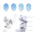
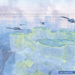
This project also closely conducted and examined airflow studies, and the direct impact that airflow has on atmospheric transportation. A composition of physical and digital models was produced using flow visualization techniques and computational fluid dynamics (CFD) studies. These CFD simulations analyzed the free-stream flow of fluids and the interactions these liquids and gases have with surfaces defined by boundary conditions. These methods were done to establish a better understanding of environmental conditions and their direct relationship to the four altitude zones that this project has pursued: streetscape (0-165ft.), low-altitude (165-650ft.), roofscape (650-1650ft.), and high-altitude (1650-3500ft.).
The flow visualization methods, as wells as CFD simulations, that were conducted supported this project’s ambitions to utilize our airspace to create an immersive infrastructure of engaging moments.
Alexandra Rees


Favorited 3 times