Kinetic Infrastructure: Two Port Paradigms of Ecuador
Global Cities are in competition with one another. Those in equatorial south are challenged to tap into the flows of economic and information currents that predominantly occur in the North. In order to keep pace with a changing market where speed, efficiency, and cost determine success or failure cities must adapt and realign. The Port is the stage where the city extends beyond its physical borders into realms that were previously out of reach.
Examination of two similar conditions at various stages of development, one of decline and one of emergence are assessed in Ecuador’s main cities: Guayaquil and Quito. What can be learned from an urban actor that is no longer economically viable? Similarly, what happens when an inserted urban actor becomes the change agent?
Guayaquil:
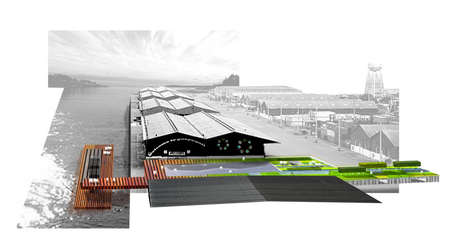
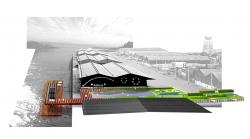
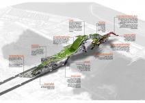
The port is fading. The largest landholder in the southern part of the city will see diminished use in the coming years due to the new Port in Posorja (70km south) and Manta to the North. The area of the port is unstable, unsafe and uninviting providing less than 100 direct, full-time positions although it does provide sporadic and indirect employment for the surrounding informal communities. A new attractor must take over for the community as the Port phases itself out. A new urban actor providing stability and generating economic growth while attracting local, regional and global visitors through a rehabilitated waterfront. Simply creating a connection to the water is crucial
Avenue de Quito bi-sects the city and serves as the main armature connecting airport, central business district, and diverse neighborhoods. Terminating at the Port of Guayaquil, the prominent axis is the likely catalyst for economic regeneration when infused with programmatic functions geared around water: ECO-PARK / AQUARIUM / CRUISE SHIP TERMINAL / INTEMODAL TRANSIT HUB. Supporting cast of Hotel, Retail + Restaurant, informal market and Event Space allow for a more robust development.
Sandwiched between flows of inbound and outbound, lies a long, narrow lot, approx. 60m wide x 1000m long. Keeping the first phase within the boundaries of the road will allow for the port (in whatever capacity) to function. Program is stacked vertically with undulating topography. Rising above the traffic and the port the visitor has a new vantage point of the surroundings. A visual connection to water and mangroves is made.
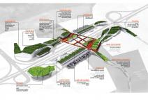
Quito:
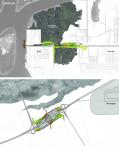
A new airport is emerging in the Yaruqui valley northeast of the city. This will spark major growth in the areas surrounding the airport and road transportation networks. Freshly paved road networks (with more on the way) will improve access to the airport. Land value will create development pressure along these corridors. Direct and In-direct businesses servicing the airport will spring up in these suburban / agricultural communities. Unless it is kept in check or planned for properly these new developments will eradicate the current identity, increase the socio-economic divide and drive some existing residents from their homes.
A new connector road has been rolled over the landscape directly south of the airport. Ripe for development due to its proximity to not only the airport but the Pan American highway, this piece of infrastructure will serve as a magnet for support programs of the airport. Its organization must be condensed and elastic allowing needs and values of surrounding undeveloped areas to be utilized for future economies of Ecuador. Methods of inclusion to benefit those outside of the airports “loop” must also be taken into account.
Airports are organized by a system of inbound and outbound flows. The movement is continuous:
Arrival/Departure
Drop-off/Pick-up
Import/Export
On-time/Delay
Adjacent service and support areas are organized in the same manner.
Functions are divided into to and from. Service roads of varying speeds, fast to slow, determine location of program and speed in which it is accessed and used. Here the road splits the site through the middle creating mirrored elements of opposite conditions. Transit hub at the central core creates inter-provincial links to surrounding cities. Utilizing a looping road technique and allowing pedestrian ROW along the outside edge helps to further organize and contain development. This condensed form allows for adjacent plots to be non-urbanized.
2007
2007
Gizem Deniz Guneri, Bernard Malafaia, Erick Gregory
.jpg)
.jpg)